Chetwode
Civil parishes in BuckinghamshireVillages in Buckinghamshire

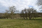
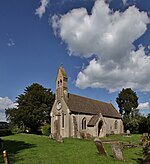
Chetwode () is a village and civil parish about 4 miles (6.4 km) southwest of Buckingham in the Aylesbury Vale district of Buckinghamshire. The parish is bounded to the southwest and southeast by a brook called The Birne, which here also forms part of the county boundary with Oxfordshire.
Excerpt from the Wikipedia article Chetwode (License: CC BY-SA 3.0, Authors, Images).Chetwode
Geographical coordinates (GPS) Address Nearby Places Show on map
Geographical coordinates (GPS)
| Latitude | Longitude |
|---|---|
| N 51.96 ° | E -1.066 ° |
Address
MK18 4LD
England, United Kingdom
Open on Google Maps


