Tingewick
Civil parishes in BuckinghamshireVillages in Buckinghamshire

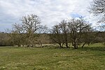
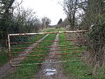
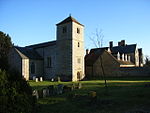
Tingewick is a village and civil parish about 2.5 miles (4.0 km) west of Buckingham in the unitary authority area of Buckinghamshire, England. The parish is bounded to the north by the River Great Ouse, to the east by a tributary of the Great Ouse, to the west by the county boundary with Oxfordshire and to the south by field boundaries. The village was formerly on the A421 but from 1998 has been bypassed by a dual carriageway. The parish comprises about 2,300 acres (930 ha) of mainly arable farmland and pasture with some woodland. Part of the village is a Conservation Area and a number of the 450 dwellings are listed buildings.
Excerpt from the Wikipedia article Tingewick (License: CC BY-SA 3.0, Authors, Images).Tingewick
Stockley's Lane,
Geographical coordinates (GPS) Address Nearby Places Show on map
Geographical coordinates (GPS)
| Latitude | Longitude |
|---|---|
| N 51.99 ° | E -1.044 ° |
Address
Stockley's Lane
Stockley's Lane
MK18 4QR , Tingewick
England, United Kingdom
Open on Google Maps


