Godington
Civil parishes in OxfordshireUse British English from August 2015Villages in Oxfordshire

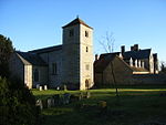
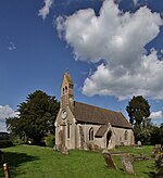
Godington is a village and civil parish about 5 miles (8 km) northeast of Bicester in Oxfordshire. The parish is bounded on all but the west side by a brook called the Birne, which at this point forms also the county boundary with Buckinghamshire. The parish was included in the figures of Stratton Audley for the purposes of the United Kingdom Census 2011.
Excerpt from the Wikipedia article Godington (License: CC BY-SA 3.0, Authors, Images).Godington
Cherwell District
Geographical coordinates (GPS) Address Nearby Places Show on map
Geographical coordinates (GPS)
| Latitude | Longitude |
|---|---|
| N 51.945 ° | E -1.066 ° |
Address
OX27 9AF Cherwell District
England, United Kingdom
Open on Google Maps


