Marie Curtis Park
Beaches of TorontoPages with non-numeric formatnum argumentsParks in Toronto

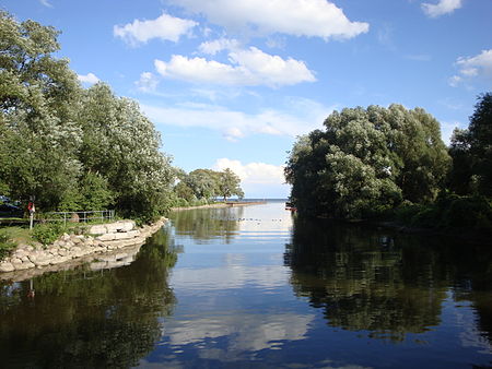
Marie Curtis Park is a public park in Toronto, Ontario, Canada. It is located at the mouth of the Etobicoke Creek on Lake Ontario in the Long Branch neighbourhood. Marie Curtis Park was built after the devastating floods of Hurricane Hazel in 1954 destroyed 56 homes and cottages on the site, leaving 1,868 persons homeless and 81 dead. It is named after Marie Curtis, the reeve of Long Branch at the time of its construction. Long Branch at the time was a separate village; it's now amalgamated into the City of Toronto government.
Excerpt from the Wikipedia article Marie Curtis Park (License: CC BY-SA 3.0, Authors, Images).Marie Curtis Park
Waterfront Trail, Toronto Etobicoke
Geographical coordinates (GPS) Address Nearby Places Show on map
Geographical coordinates (GPS)
| Latitude | Longitude |
|---|---|
| N 43.586666666667 ° | E -79.543888888889 ° |
Address
Waterfront Trail
Waterfront Trail
M8W 3P1 Toronto, Etobicoke
Ontario, Canada
Open on Google Maps


