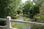
Clarendon Park, Wiltshire
Civil parishes in WiltshireCommons category link is the pagenameCountry houses in WiltshireGeorgian architecture in WiltshireGrade I listed buildings in Wiltshire ... and 2 more
Grade I listed housesHouses completed in 1737

Clarendon Park is a Grade I listed building, estate and civil parish near Salisbury in Wiltshire, England. At the 2011 census the population of the parish was 246.The parish is almost entirely farmland, with parkland and gardens around the 18th-century house. In the southwest the parish extends to the Petersfinger area on the western outskirts of Salisbury, and the west bank of the Salisbury Avon. The Clarendon Way recreational footpath passes through the parish.
Excerpt from the Wikipedia article Clarendon Park, Wiltshire (License: CC BY-SA 3.0, Authors, Images).Clarendon Park, Wiltshire
Clarendon Road,
Geographical coordinates (GPS) Address External links Nearby Places Show on map
Geographical coordinates (GPS)
| Latitude | Longitude |
|---|---|
| N 51.0555 ° | E -1.7227 ° |
Address
Clarendon House
Clarendon Road
SP5 3EW , Alderbury
England, United Kingdom
Open on Google Maps


