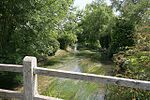
Alderbury
Civil parishes in WiltshireEngvarB from August 2019OpenDomesdayVillages in Wiltshire

Alderbury is a village and civil parish in Wiltshire, England, in the south of the county around 3 miles (5 km) southeast of Salisbury.The parish includes the village of Whaddon, which is adjacent to Alderbury, and the hamlet of Shute End. The River Avon forms the western boundary of the parish. The villages are on the Salisbury-Southampton road which became the A36 primary route; a bypass was opened in 1978, taking the A36 to the east of the villages.
Excerpt from the Wikipedia article Alderbury (License: CC BY-SA 3.0, Authors, Images).Alderbury
Southampton Road,
Geographical coordinates (GPS) Address Nearby Places Show on map
Geographical coordinates (GPS)
| Latitude | Longitude |
|---|---|
| N 51.043 ° | E -1.732 ° |
Address
Southampton Road
Southampton Road
SP5 3EA , Alderbury
England, United Kingdom
Open on Google Maps


