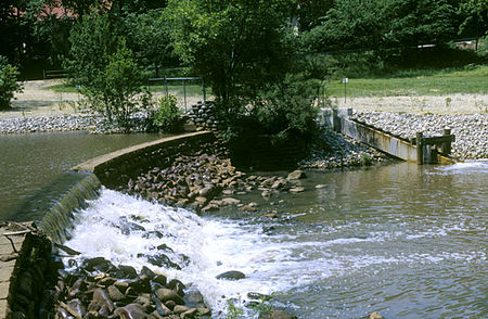
Cooper River (New Jersey)

The Cooper River is a tributary of the Delaware River in southwestern New Jersey in the United States.The confluence of the Cooper River with the Delaware River is in Camden. The Cooper River serves as a border between Cherry Hill and Haddon Township, Haddonfield, and Lawnside. The Cooper River (known upstream near Haddonfield as Cooper's Creek) was named after the Cooper family, who were some of the first European settlers in the area of Camden County, New Jersey. This tributary of the Delaware River is 16 miles (25.7 km) long measuring from its headwater in Gibbsboro (it is notable that the Northern Branch begins in Voorhees Township). The Cooper River Watershed covers 40 square miles (100 km2), and includes the tributaries Chandlers Run, Millard Creek, Nicholson Branch, the North Branch, and Tindale Run (the last two being the most significant). Although historically a tidal river (the most severe tide reportedly reached Kings Highway), all present tidal influence stops at the Kaighn Avenue Bridge, in Camden, where it is impounded. The Cooper flows through Barrington, Berlin Township, Camden, Cherry Hill, Collingswood, Gibbsboro, Haddon Township, Haddonfield, Lawnside, Lindenwold, Magnolia, Merchantville, Pennsauken Township, Somerdale, Stratford, Tavistock and Voorhees Township.The Cooper also has seven impoundments, not listed in geographical order: Cooper River Lake, Evans Pond, Hopkins Pond, Kirkwood Lake, Linden Lake, Square Circle Lake, Wallworth Lake.
Excerpt from the Wikipedia article Cooper River (New Jersey) (License: CC BY-SA 3.0, Authors, Images).Cooper River (New Jersey)
South Park Drive Path,
Geographical coordinates (GPS) Address Nearby Places Show on map
Geographical coordinates (GPS)
| Latitude | Longitude |
|---|---|
| N 39.92514 ° | E -75.07009 ° |
Address
Cooper River Trail Parking
South Park Drive Path
08108
New Jersey, United States
Open on Google Maps


