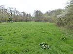
Lindfield Rural
Mid Sussex DistrictWest Sussex geography stubs

Lindfield Rural is a civil parish in the Mid Sussex District of West Sussex, England. It is located on the southern slopes of the Weald, five miles (8 km) to the east of Haywards Heath. It covers an area of 1,981 hectares (4,900 acres) and has a population of 2644 persons (2001 census). The parish council meets in the Millennium Hall in the village of Scaynes Hill.
Excerpt from the Wikipedia article Lindfield Rural (License: CC BY-SA 3.0, Authors, Images).Lindfield Rural
Scaynes Hill Road, Mid Sussex Lindfield Rural
Geographical coordinates (GPS) Address Nearby Places Show on map
Geographical coordinates (GPS)
| Latitude | Longitude |
|---|---|
| N 51.00467 ° | E -0.07016 ° |
Address
Scaynes Hill Road
Scaynes Hill Road
RH16 2QQ Mid Sussex, Lindfield Rural
England, United Kingdom
Open on Google Maps


