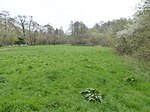
Forest Way
1866 establishments in EnglandCountry parks in East SussexCycleways in EnglandEast GrinsteadFootpaths in East Sussex ... and 5 more
Long-distance footpaths in EnglandRail trails in EnglandRailway lines closed in 1966Railway lines opened in 1866Use British English from April 2017

The Forest Way is a linear Country park providing walking, cycling, horse riding and the quiet enjoyment of the countryside. It runs for around 16 km from East Grinstead to Groombridge. The Forest Way lies within the High Weald Area of Outstanding Natural Beauty in the heart of the picturesque East Sussex countryside with the Ashdown Forest lying to the south. It takes the route of a disused railway line and now provides an important habitat for wildlife forming a ‘green corridor’ through the upper valley of the River Medway. The route runs from East Grinstead, via Forest Row, Hartfield, and Withyham to Groombridge.
Excerpt from the Wikipedia article Forest Way (License: CC BY-SA 3.0, Authors, Images).Forest Way
High Street, Mid Sussex Lindfield Rural
Geographical coordinates (GPS) Address Nearby Places Show on map
Geographical coordinates (GPS)
| Latitude | Longitude |
|---|---|
| N 51.016666666667 ° | E -0.066666666666667 ° |
Address
Dean's Watermill
High Street
RH16 2QY Mid Sussex, Lindfield Rural
England, United Kingdom
Open on Google Maps


