Laverstock
Civil parishes in WiltshireEngvarB from July 2016OpenDomesdayVillages in Wiltshire

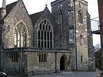
Laverstock is a village and civil parish on the north-east and east outskirts of Salisbury in the ceremonial county of Wiltshire, England. The parish is shaped like a figure 7 and incorporates Ford hamlet, the eastern half of the former manor of Milford, the area near the ancient settlement of Old Sarum, and part of the Hampton Park district on the edge of Salisbury. Laverstock, the parish's main settlement, lies on the east bank of the River Bourne and is approximately 1 mile (1.6 km) east of Salisbury city centre, 33 miles (53 km) due south of Swindon and 77 miles (124 km) west-southwest of London.
Excerpt from the Wikipedia article Laverstock (License: CC BY-SA 3.0, Authors, Images).Laverstock
Laverstock Park West,
Geographical coordinates (GPS) Address Nearby Places Show on map
Geographical coordinates (GPS)
| Latitude | Longitude |
|---|---|
| N 51.076 ° | E -1.774 ° |
Address
Laverstock Park West
Laverstock Park West
SP1 1QL , Laverstock
England, United Kingdom
Open on Google Maps


