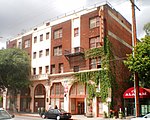
Central-Alameda, Los Angeles
Neighborhoods in Los AngelesSouth Los Angeles

Central-Alameda is a 2.18 square miles (5.65 km2) square mile neighborhood within the South Los Angeles region of Los Angeles, California.
Excerpt from the Wikipedia article Central-Alameda, Los Angeles (License: CC BY-SA 3.0, Authors, Images).Central-Alameda, Los Angeles
East 50th Street, Los Angeles Central-Alameda
Geographical coordinates (GPS) Address Nearby Places Show on map
Geographical coordinates (GPS)
| Latitude | Longitude |
|---|---|
| N 33.9975 ° | E -118.2479 ° |
Address
#75
East 50th Street
90011 Los Angeles, Central-Alameda
California, United States
Open on Google Maps


