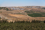
Dayshum
Arab villages depopulated during the 1948 Arab–Israeli WarDistrict of SafadPages with non-numeric formatnum arguments

Dayshum (Arabic: ديشوم) was a Palestinian village, depopulated on 30 October 1948 by the Sheva Brigade of Israeli paramilitary force Palmach in an offensive called Operation Hiram, where the village has been destroyed, and only house rubble left behind. The village was located 12 kilometers (7.5 mi) north of Safed, 600 meters (2,000 ft) above sea level.
Excerpt from the Wikipedia article Dayshum (License: CC BY-SA 3.0, Authors, Images).Dayshum
886, Merom HaGalil Regional Council
Geographical coordinates (GPS) Address Nearby Places Show on map
Geographical coordinates (GPS)
| Latitude | Longitude |
|---|---|
| N 33.078333333333 ° | E 35.509444444444 ° |
Address
עין דישון
886
1311502 Merom HaGalil Regional Council
North District, Israel
Open on Google Maps


