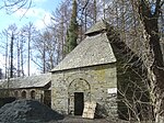
Llanegryn
Communities in GwyneddHistory of GwyneddUse British English from March 2015Villages in GwyneddVillages in Snowdonia

Llanegryn is a village and a community in Gwynedd, north-west Wales. It was formerly part of the historic county of Merionethshire (Welsh: Meirionnydd, Sir Feirionnydd). It is located within Snowdonia National Park south of the Snowdonia (Eryri) mountain range. Travelling by road, it is around 4 miles (6 km) north-east of Tywyn and 17 miles (27 km) south-west of Dolgellau. The nearest railway stations are at Tonfanau and Llwyngwril, both less than 3 miles (5 km) away. Llanegryn is named for St Egryn, with llan meaning church or parish – a common feature in Welsh place names. The village lies in the Dysynni Valley (Dyffryn Dysynni).
Excerpt from the Wikipedia article Llanegryn (License: CC BY-SA 3.0, Authors, Images).Llanegryn
Geographical coordinates (GPS) Address Nearby Places Show on map
Geographical coordinates (GPS)
| Latitude | Longitude |
|---|---|
| N 52.628 ° | E -4.068 ° |
Address
LL36 9SW
Wales, United Kingdom
Open on Google Maps


