Freebridge Lynn Rural District
Districts of England abolished by the Local Government Act 1972Districts of England created by the Local Government Act 1894Historical districts of NorfolkRural districts of EnglandUse British English from August 2012
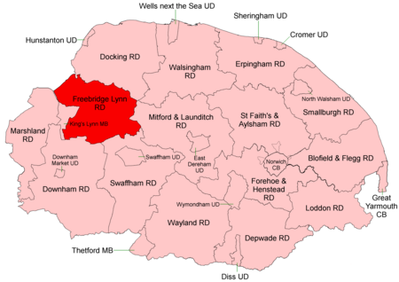
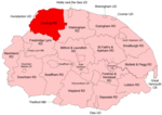
Freebridge Lynn Rural District was a rural district in Norfolk, England from 1894 to 1974.It was formed under the Local Government Act 1894 based on the Freebridge Lynn rural sanitary district, and was named after the Freebridge Lynn hundred. It covered an area to the east of King's Lynn. It was reduced somewhat in 1935 when under a County Review Order, the civil parishes of Gaywood and North Lynn became part of the borough of King's Lynn. In 1974, the district was abolished under the Local Government Act 1972, and became part of the West Norfolk district.
Excerpt from the Wikipedia article Freebridge Lynn Rural District (License: CC BY-SA 3.0, Authors, Images).Freebridge Lynn Rural District
Gayton Road, King's Lynn and West Norfolk East Winch
Geographical coordinates (GPS) Address Nearby Places Show on map
Geographical coordinates (GPS)
| Latitude | Longitude |
|---|---|
| N 52.73 ° | E 0.53 ° |
Address
Gayton Road
Gayton Road
PE32 1LH King's Lynn and West Norfolk, East Winch
England, United Kingdom
Open on Google Maps
