Dzierżoniów

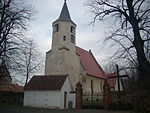
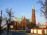
Dzierżoniów (Polish: [d͡ʑɛrˈʐɔɲuf] ; Silesian: Rychbach; German: Reichenbach im Eulengebirge [ˈʁaɪçn̩bax]) is a town located at the foot of the Owl Mountains in southwestern Poland, within the Lower Silesian Voivodeship (from 1975 to 1998 in the former Wałbrzych Voivodeship). It is the seat of Dzierżoniów County, and of Gmina Dzierżoniów (although it is not part of the territory of the latter, since the town forms a separate urban gmina). Established in the 13th century, Dzierżoniów is a historical Lower Silesian town that covers an area of 20.1 square kilometres (7.8 sq mi), and as of December 2021 it has a population of 32,346. It is named after Polish priest and scientist Jan Dzierżon.Unique and architecturally rich, Dzierżoniów features a central market square with elegant tenements and a town hall as well as few museums and restaurants. The Old Town is a venue for several annual events and fairs.
Excerpt from the Wikipedia article Dzierżoniów (License: CC BY-SA 3.0, Authors, Images).Dzierżoniów
Rynek,
Geographical coordinates (GPS) Address Nearby Places Show on map
Geographical coordinates (GPS)
| Latitude | Longitude |
|---|---|
| N 50.728055555556 ° | E 16.651111111111 ° |
Address
Rynek 1
58-200
Lower Silesian Voivodeship, Poland
Open on Google Maps


