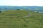
Croker Hill
Cheshire geography stubsHills of CheshireMountains and hills of the Peak District

Croker Hill stands just outside the western edge of the Peak District national park, overlooking Congleton in Cheshire. Near the summit stands the Sutton Common BT Tower, built during the 1960s. Popular with hill walkers, Croker Hill offers fine views of the Cheshire Plain; on clear days, Manchester city centre and as far away as Snowdon can be seen.
Excerpt from the Wikipedia article Croker Hill (License: CC BY-SA 3.0, Authors, Images).Croker Hill
Buxton Road,
Geographical coordinates (GPS) Address Nearby Places Show on map
Geographical coordinates (GPS)
| Latitude | Longitude |
|---|---|
| N 53.206133 ° | E -2.1007 ° |
Address
Sutton Common BT Tower
Buxton Road
SK11 0PX , Sutton
England, United Kingdom
Open on Google Maps


