Sutton Lane Ends

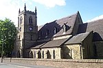
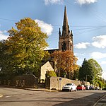
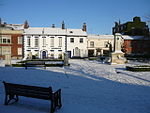
Sutton Lane Ends or Sutton is a semi-rural village and civil parish, approximately one mile south of Macclesfield. In 2020 it had an estimated population of 936. The parish includes the villages of Langley and Oakgrove and the hamlets of Gurnett, Jarman and Lyme Green. Sutton is in the unitary authority of Cheshire East and the ceremonial county of Cheshire, England. The rivers Bollin and Rosendale run through Sutton Lane Ends, as does the Macclesfield Canal. The population of the entire civil parish is 2,464. In the past, the community was centred on farming, forestry and textiles; however, since these industries declined, most of the population now travel to nearby Macclesfield or Manchester for employment.Sutton Lane Ends has had an Anglican church, Sutton St. James, since 1840. The community of Sutton is served by a village shop, primary school (Hollinhey Primary School) and five public houses.
Excerpt from the Wikipedia article Sutton Lane Ends (License: CC BY-SA 3.0, Authors, Images).Sutton Lane Ends
Trinity Lane,
Geographical coordinates (GPS) Address Nearby Places Show on map
Geographical coordinates (GPS)
| Latitude | Longitude |
|---|---|
| N 53.237962 ° | E -2.106114 ° |
Address
St James C of E Church
Trinity Lane
SK11 0EQ , Lyme Green
England, United Kingdom
Open on Google Maps


