place

Bosley railway station

1849 establishments in EnglandDisused railway stations in CheshireFormer North Staffordshire Railway stationsPages with no open date in Infobox stationRailway stations in Great Britain closed in 1960
Railway stations in Great Britain opened in 1849Use British English from December 2016
Bosley railway station

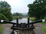
Bosley railway station served the village of Bosley, Cheshire. The station was opened by the North Staffordshire Railway in September 1849 as part of the Churnet Valley line.The station was some distance from the village, to which it was linked by a footpath. To travel between the village and the station by road was a much longer journey. The main customer of the station was the corn mill belonging to Francis R Thompstone & Sons Ltd which was situated next to the station. Thompstones also had their own 2 ft 6 in (762 mm) tramway which ran for 0.75 miles (1.21 km) from the mill to the Macclesfield Canal and was used for transporting corn from the canal to the mill. The tramway opened in 1887 and closed around 1925. Remains of the track can still just be seen in a shallow cutting through woodland, leading to the old transhipment dock, just below Bosley bottom lock.Bosley station remained open until passenger services were withdrawn from the northern end of the Churnet valley line (North Rode – Leek) in 1960. Freight services lasted until 1964 when they too were withdrawn and the track lifted.Today, the station remains as a private residence and the church near it still remains active. The trackbed has been built on by industrial buildings. The trackbed can be traced on a map to Leek and Macclesfield.

Excerpt from the Wikipedia article Bosley railway station (License: CC BY-SA 3.0, Authors, Images).

Bosley railway station
Tunstall Road,

Geographical coordinates (GPS) Address Nearby Places
placeShow on map

Wikipedia: Bosley railway stationContinue reading on Wikipedia

Geographical coordinates (GPS)

Latitude Longitude
N 53.18317 ° E -2.13155 °
placeShow on map

Address

Tunstall Road

Tunstall Road
SK11 0PB , Bosley
England, United Kingdom
mapOpen on Google Maps

Bosley railway station
Share experience

Nearby Places

Gritstone Trail
Gritstone Trail

The Gritstone Trail, or Cheshire Gritstone Trail, is a 35-mile (56 km) long-distance footpath in England which follows the most westerly hills of the Peak District from Disley Station to Mow Cop, and on via the Macclesfield Canal to Kidsgrove Station. Managed by Cheshire East (although partly in Staffordshire), the trail involves 5,900 feet (1,800 m) of ascent and is mainly outside the National Park. There are other routes in the Peak District referred to as a “Gritstone Trail” but they are less well established. The trail connects the accessible and popular outdoor destinations of Lyme Park, White Nancy, Tegg's Nose and The Cloud, and the high sections of the trail are all notable for gritstone scenery and extensive views over the Cheshire Plain. Apart from the café at Tegg's Nose, there are no facilities on the route. Most through hikers take 3 days (stopping at Macclesfield and Congleton) to complete the trail, traditionally (but for no particular reason) walked north to south, though the trail is more often used for shorter walks. The record in the annual Gritstone Grind (run south to north) is just under 5 hours. Footpaths in Cheshire are marked with yellow discs indicating the direction of continuation, with Gritstone Trail Markers containing a footprint inscribed with a 'G'. There are also many wooden fingerposts with 'Gritstone Trail' engraved. An unofficial extension from Kidsgrove to the mainline railway station at Stoke-on-Trent, The Kidsgrove to Stoke Ridgeway, is available as a free ebook.