Metropolitan Borough of St Marylebone

The Metropolitan Borough of St Marylebone was a metropolitan borough of the County of London from 1900 to 1965. It was based directly on the previously existing civil parish of St Marylebone, which was incorporated into the Metropolitan Board of Works area in 1855, retaining a parish vestry, and then became part of the County of London in 1889. It was that part of the current City of Westminster which is north of Oxford Street, and east of Maida Vale and Edgware Road. It included the areas Marylebone, Regent's Park, St John's Wood, and Lisson Grove, along with the western part of the district of Fitzrovia. In 1965 it was abolished and its former area was amalgamated with that of the Metropolitan Borough of Paddington and the Metropolitan Borough of Westminster to form the City of Westminster.
Excerpt from the Wikipedia article Metropolitan Borough of St Marylebone (License: CC BY-SA 3.0, Authors, Images).Metropolitan Borough of St Marylebone
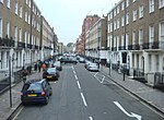
Upper Montagu Street, London Marylebone
Geographical coordinates (GPS) Address Nearby Places Show on map
Geographical coordinates (GPS)
| Latitude | Longitude |
|---|---|
| N 51.5213 ° | E -0.1601 ° |
Address
London Business School
Upper Montagu Street
W1H 1SJ London, Marylebone
England, United Kingdom
Open on Google Maps


