place

Bawden Rocks

Cornwall geography stubsUninhabited islands of Cornwall
Bawden Rocks geograph.org.uk 469385

Bawden Rocks (Cornish: Meyn Bodyn), also known as Cow and Calf or Man and His Man, are a pair of small islands approximately one mile north of St Agnes Head, off the coast of Cornwall, England, United Kingdom. The larger of the two rocks stands around 80 ft (24 m) above the high water mark.The rocks are popular with swimmers, divers, anglers and trawler fishermen, being home to a wide range of marine life. Sea anemones, molluscs and crustaceans of various types cling to the rock walls below the surface of the sea, together with marine animals such as the threatened broad sea fan.The rocks are also a nesting ground for a number of seabird species, including razorbills, cormorants, guillemots, great black-backed gulls and puffins.A local legend claims that the rocks were thrown out to sea by a child-eating giant called Bolster, after whom Bolster Day was named.

Excerpt from the Wikipedia article Bawden Rocks (License: CC BY-SA 3.0, Authors, Images).

Geographical coordinates (GPS)

Latitude Longitude
N 50.334 ° E -5.232 °
placeShow on map

Address

St Agnes Head


TR5 0NU
England, United Kingdom
mapOpen on Google Maps

Bawden Rocks geograph.org.uk 469385
Share experience

Nearby Places

Great Wheal Charlotte

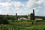
Great Wheal Charlotte, also known as Wheal Charlotte, is an abandoned copper and tin mine near St Agnes in Cornwall, England. All that is left of the mine now is the wall and door arch of the engine house and an adjacent fenced-off mine shaft. Great Wheal Charlotte opened in 1806. It was originally called North Towan. After operating profitably for a period, it was renamed Wheal Towan; however, the mine closed shortly afterwards. It opened again in the late 1820s, and was renamed New Charlotte and after that Great Wheal Charlotte. In 1877 it was renamed Charlotte United.The engine house held a 60-inch pump and was built in 1828. It would have also contained two boilers and would have had a chimney. The main shaft at Great Wheal Charlotte is engine shaft which is 82 fathoms and is located next to the remnant of the engine house. Other shafts can be seen in the surrounding area of the mine. Great Wheal Charlotte is on the South West Coast Path and was purchased by the National Trust in 1956.This entry has mixed up two different mines... Little more than a bob wall remains of Great Wheal Charlotte, along the Coast Path. The picture is of Charlotte United Mine's Pumping engine house which was consolidated in 2014 and is on the side of Mulgram Hill, slightly further inland. There has been no chimney collapse. It was this area that was formerly known as North Towan. North Towan was not successful and was abandoned not long after it opened in 1805. This was probably at the site of the shaft further up the hill from the remaining house.

Hanover (ship)
Hanover (ship)

Hanover was a two-masted brigantine packet ship owned and operated by the Falmouth Post Office Packet Service, which operated between 1688 and 1852.On 13 December 1763, under the command of Captain Joseph Sherbourne and en route from Lisbon to Falmouth, she was driven ashore by a gale. There were only three survivors out of 27 crew and 40 passengers. The location, near Perranporth has become known as Hanover Cove as a result. At the time she was carrying a large amount of gold and valuables; historical evidence suggests that this was mostly recovered around the time of the wrecking.The wreck made legal history, when in 1765 an iron trunk containing bullion was recovered. The insurers had already paid out on the loss and the case established that where insurers paid out on cargo and the owners subsequently recovered their property, the insurers were entitled to a refund.The wreck was discovered by local diver Colin Martin in 1994 following changes in the seabed and was identified by means of recovery of the ship's bell. The Post Office as owners of the wreck paid for an archaeological investigation and recommended in 1996 that it should be protected under the Protection of Wrecks Act. However, protection was not granted. It was not until 19 July 1997, that the wreck site received emergency designation following the recovery of some fifty guns and the destabilisation of the wreck by a salvage rig set up next to it. The finder was subsequently licensed to excavate under archaeological supervision with the intention of displaying finds in a local shipwreck museum. Musket, shot, ship-fittings and the Captain's ring have also been brought to the surface. The wreck site has since been protected by return of the sand covering.The wreck is a Protected Wreck managed by Historic England. In 2016, Cotswold Archaeology was commissioned by Historic England to use marine assessment to investigate the possible de-designation on three designated wreck sites, including the Hanover. Some doubt had been raised in earlier reports as to the definitive identification of the wreck as the Hanover, and criticism was made of the way the salvage from the wreck had been undertaken, with a failure to record finds and information in a professional manner.