St Agnes, Cornwall

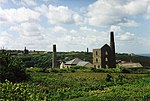
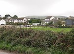
St Agnes (Standard Written Form: Breanek) is a civil parish and a large village on the north coast of Cornwall, England, United Kingdom. The village is about five miles (8 km) north of Redruth and ten miles (16 km) southwest of Newquay. An electoral ward exists stretching as far south as Blackwater. The population at the 2011 census was 7,565.The village of St Agnes, a popular coastal tourist spot, lies on a main road between Redruth and Perranporth. It was a prehistoric and modern centre for mining of copper, tin and arsenic until the 1920s. Local industry has also included farming, fishing and quarrying, and more recently tourism. The St Agnes district has a heritage of industrial archaeology and much of the landscape is of considerable geological interest. There are also stone-age remains in the parish. The manor of Tywarnhaile was one of the 17 Antiqua maneria of the Duchy of Cornwall.
Excerpt from the Wikipedia article St Agnes, Cornwall (License: CC BY-SA 3.0, Authors, Images).St Agnes, Cornwall
Churchtown,
Geographical coordinates (GPS) Address Nearby Places Show on map
Geographical coordinates (GPS)
| Latitude | Longitude |
|---|---|
| N 50.312 ° | E -5.204 ° |
Address
Select Convenience
Churchtown 4
TR5 0QW , St. Agnes
England, United Kingdom
Open on Google Maps


