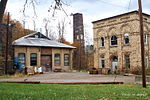
Allegheny Highlands Trail of Maryland
Allegany County, Maryland geography stubsMaryland protected area stubsParks in Cumberland, MD-WV-PAProtected areas of Allegany County, MarylandRail trails in Maryland ... and 3 more
Tourist attractions in Cumberland, MD-WV-PATransportation in Allegany County, MarylandUnited States trail stubs

The Allegheny Highlands Trail of Maryland (AHTM) is a 20.47-mile (32.94 km) long rail trail between the C&O Canal in Cumberland and the Mason–Dixon line, where it meets the Allegheny Highlands Trail of Pennsylvania. It forms part of the Pittsburgh–Washington, DC Great Allegheny Passage. The trail follows the route of the Connellsville extension of the Western Maryland Railway. Track still parallels the trail between Cumberland and Frostburg; it is used by the Western Maryland Scenic Railroad.
Excerpt from the Wikipedia article Allegheny Highlands Trail of Maryland (License: CC BY-SA 3.0, Authors, Images).Allegheny Highlands Trail of Maryland
Great Allegheny Passage,
Geographical coordinates (GPS) Address Nearby Places Show on map
Geographical coordinates (GPS)
| Latitude | Longitude |
|---|---|
| N 39.695555555556 ° | E -78.846527777778 ° |
Address
Great Allegheny Passage
Great Allegheny Passage
21545
Maryland, United States
Open on Google Maps


