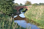
Kilvington
EngvarB from May 2016Newark and SherwoodNottinghamshire geography stubsOpenDomesdayVillages in Nottinghamshire
Kilvington is a hamlet and civil parish in Nottinghamshire, England, part of the Newark and Sherwood district. Dr Robert Thoroton in Antiquities of Nottinghamshire mentions enclosure 'about the Year 1750', but an Act of Parliament to enclose about 400 acres was passed in 1804 and the Award, mentioning 410 acres of the township of Alverton in Staunton, together with Kilvington, is dated 1810.It is combined with its neighbouring parish of Alverton to form an area for a parish meeting. Population information is included in the civil parish of Staunton.
Excerpt from the Wikipedia article Kilvington (License: CC BY-SA 3.0, Authors).Kilvington
Newark and Sherwood
Geographical coordinates (GPS) Address Nearby Places Show on map
Geographical coordinates (GPS)
| Latitude | Longitude |
|---|---|
| N 52.981 ° | E -0.808 ° |
Address
NG13 9PH Newark and Sherwood
England, United Kingdom
Open on Google Maps


