place

West Lynn, Norfolk

Former civil parishes in NorfolkKing's LynnNorfolk geography stubsVillages in Norfolk
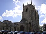
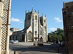
St Peter Church, West Lynn geograph.org.uk 273642

West Lynn is a suburb of King's Lynn in Norfolk, England. It is the part of the town lying on the west bank of the River Great Ouse, linked to the main part of the town on the east bank by a passenger ferry or by a more circuitous 4 km road journey.West Lynn was an ancient parish, and until 1935 it was outside the borough boundaries of King's Lynn. From 1894 it was the sole parish in King's Lynn Rural District. In 1931 the parish had a population of 931. The parish was abolished on 1 April 1935. The more built-up part, including the old West Lynn village, became part of the borough of King's Lynn. The rest of the former parish was transferred to Clenchwarton in Marshland Rural District. It is in the South and West Lynn Ward of King's Lynn and West Norfolk Council.West Lynn has a primary school and a range of basic services. West Lynn Primary School received a "good" rating from Ofsted in 2019.

Excerpt from the Wikipedia article West Lynn, Norfolk (License: CC BY-SA 3.0, Authors, Images).

West Lynn, Norfolk
Ferry Square, King's Lynn and West Norfolk

Geographical coordinates (GPS) Address Nearby Places
placeShow on map

Wikipedia: West Lynn, NorfolkContinue reading on Wikipedia

Geographical coordinates (GPS)

Latitude Longitude
N 52.75626 ° E 0.38726 °
placeShow on map

Address

Ferry Square

Ferry Square
PE34 3JQ King's Lynn and West Norfolk
England, United Kingdom
mapOpen on Google Maps

St Peter Church, West Lynn geograph.org.uk 273642
Share experience

Nearby Places

Gaywood River
Gaywood River

Gaywood River (sometimes known as the River Gay or River Gaywood or, in King's Lynn, as the Mill Fleet) is a tributary of the River Great Ouse in the west of the county of Norfolk. Its source is 11 metres above sea level, northwest of the village of Gayton in Derby Fen, Map Reference TF 705 209. It runs for 6.7 miles (10.8 km) to its outflow into the River Great Ouse in the town of King's Lynn. Derby Fen is the remnant of a valley fen system once found in these parts. The remnant supports a range of habitats from dry calcareous to damp acidic grasslands and heath which all rely on the river. From Derby Fen the stream runs under Leziate Drove and along the southern side of Sugar Fen after which the river passes into the open countryside. In recent years, attempts have been made to restore the river to its original meandering course in the section of the river. With these improvements there have been recordings of water vole, and otter sightings. The river also has a small trout population although only the lower reaches of the river support any coarse fishing. Just north of the village of Bawsey the river passes under a disused railway track bed and crosses the countryside westwards and skirts to the north of the ruins of St. James’ church which stands on the small hill to the south of the river. Then the river passes under the A149, King's Lynn to Hunstanton road. Now in the lower reaches and entering the outskirts of King's Lynn the river banks have been the subject of much flood defence work. Skirting the southern side of South Wootton the river passes under the A148 and turns southwards alongside a residential street called Riverside for a short distance before running along the eastern boundary of sports fields close to King’s Lynn Leisure Centre. It is now in the district of King’s Lynn called Gaywood and here the river runs alongside River Lane before it dog-legs west towards the town centre along Swan Lane. From Swan Lane it passes through some open land and the allotments to the south before changing direction south again by Kettlewell Lane.