King's Lynn and West Norfolk
Boroughs in EnglandKing's Lynn and West NorfolkNon-metropolitan districts of Norfolk

King's Lynn and West Norfolk is a local government district with borough status in Norfolk, England. Its council is based in the town of King's Lynn. The district also includes the towns of Downham Market and Hunstanton, along with numerous villages and surrounding rural areas. The population of the district at the 2021 census was 154,325.Part of the borough lies within the Norfolk Coast Area of Outstanding Natural Beauty. The borough lies on the coast, facing both The Wash to the west and the North Sea to the north. The neighbouring districts are North Norfolk, Breckland, West Suffolk, East Cambridgeshire, Fenland and South Holland.
Excerpt from the Wikipedia article King's Lynn and West Norfolk (License: CC BY-SA 3.0, Authors, Images).King's Lynn and West Norfolk
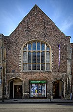
Norfolk Street, King's Lynn and West Norfolk North Lynn
Geographical coordinates (GPS) Address Website Nearby Places Show on map
Geographical coordinates (GPS)
| Latitude | Longitude |
|---|---|
| N 52.7549 ° | E 0.3962 ° |
Address
WHSmith
Norfolk Street 7
PE30 1AR King's Lynn and West Norfolk, North Lynn
England, United Kingdom
Open on Google Maps


