place

Thoresby College

Defunct schools in NorfolkGrade I listed buildings in NorfolkKing's LynnUse British English from February 2023
Courtyard of Thoresby College, Queen Street, King's Lynn geograph.org.uk 801016

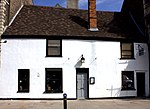
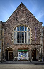
Thoresby College (also Trinity College) was a 16th-century collegiate-style residence for thirteen chantry priests in King's Lynn, Norfolk, East of England. Located on Queen Street opposite the Guildhall, it has been converted into a youth hostel, and offices for the King`s Lynn Preservation Trust. It is a Grade I listed building.The priests were employed by the Trinity Guild of King’s Lynn. Its founder and benefactor, Thomas Thoresby, was a merchant and three times Mayor of the town; he died in 1510 before the building was completed. Notable features include a Dutch gable front, the interior has exposed wood beams. The original great door was decorated with parchemin panels.

Excerpt from the Wikipedia article Thoresby College (License: CC BY-SA 3.0, Authors, Images).

Thoresby College
College Lane, King's Lynn and West Norfolk South Lynn

Geographical coordinates (GPS) Address Nearby Places
placeShow on map

Wikipedia: Thoresby CollegeContinue reading on Wikipedia

Geographical coordinates (GPS)

Latitude Longitude
N 52.752 ° E 0.394 °
placeShow on map

Address

College Lane

College Lane
PE30 5DT King's Lynn and West Norfolk, South Lynn
England, United Kingdom
mapOpen on Google Maps

Courtyard of Thoresby College, Queen Street, King's Lynn geograph.org.uk 801016
Share experience

Nearby Places

Gaywood River
Gaywood River

Gaywood River (sometimes known as the River Gay or River Gaywood or, in King's Lynn, as the Mill Fleet) is a tributary of the River Great Ouse in the west of the county of Norfolk. Its source is 11 metres above sea level, northwest of the village of Gayton in Derby Fen, Map Reference TF 705 209. It runs for 6.7 miles (10.8 km) to its outflow into the River Great Ouse in the town of King's Lynn. Derby Fen is the remnant of a valley fen system once found in these parts. The remnant supports a range of habitats from dry calcareous to damp acidic grasslands and heath which all rely on the river. From Derby Fen the stream runs under Leziate Drove and along the southern side of Sugar Fen after which the river passes into the open countryside. In recent years, attempts have been made to restore the river to its original meandering course in the section of the river. With these improvements there have been recordings of water vole, and otter sightings. The river also has a small trout population although only the lower reaches of the river support any coarse fishing. Just north of the village of Bawsey the river passes under a disused railway track bed and crosses the countryside westwards and skirts to the north of the ruins of St. James’ church which stands on the small hill to the south of the river. Then the river passes under the A149, King's Lynn to Hunstanton road. Now in the lower reaches and entering the outskirts of King's Lynn the river banks have been the subject of much flood defence work. Skirting the southern side of South Wootton the river passes under the A148 and turns southwards alongside a residential street called Riverside for a short distance before running along the eastern boundary of sports fields close to King’s Lynn Leisure Centre. It is now in the district of King’s Lynn called Gaywood and here the river runs alongside River Lane before it dog-legs west towards the town centre along Swan Lane. From Swan Lane it passes through some open land and the allotments to the south before changing direction south again by Kettlewell Lane.

River Nar
River Nar

The River Nar is a river in England, a tributary of the River Great Ouse. It rises at Mileham near Litcham in Norfolk and flows 15 miles west through Castle Acre and Narborough (the latter giving the Nar its name), joining the Ouse at King's Lynn. It has had a variety of alternative names, such as the Setch, the Sandringham, and Lynn Flu, though these are rarely, if ever, used today. In 2011 the Nar was recognised by the Environment Agency as one of the top ten most improved rivers in England and Wales. The final section of the river near its mouth was diverted northwards when the Great Ouse was re-routed to a new outfall at King's Lynn after the thirteenth century. The river was made navigable from its mouth to Narborough and probably to West Acre as a result of an Act of Parliament obtained in 1751. Ten single-gate sluices and a pen sluice (or pound lock) were used to handle the change in level. The use of the river declined rapidly after the opening of a railway from King's Lynn to Dereham between 1846 and 1848. In 1884, the river was taken over by the River Nar Drainage Board, and closed to navigation, when an un-navigable sluice was constructed to the south of a Manure Factory in King's Lynn. A new sluice very close to the junction with the Great Ouse has been built more recently. The river has been used to power a number of mills over the centuries. The buildings or remains of five are still visible, and some still contain original machinery. Narborough Bone Mill had no road access, and bones from the whaling industry and from cemeteries in Hamburg were delivered by barge, to be ground into bone meal. The mill closed when the river was taken over, and just the mill wheel remains on the bank. The river is a 42-kilometre (26-mile) long biological Site of Special Scientific Interest.