Wivelsfield

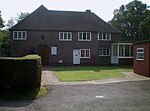
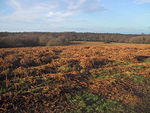
Wivelsfield () village and the larger adjacent village of Wivelsfield Green are the core of the civil parish of Wivelsfield in the Lewes District of East Sussex, England. The villages are 9.3 miles (15.0 km) north of the city of Brighton and Hove. Wivelsfield parish is located on a ridge that divides the watersheds of the Rivers Adur and Ouse. It lies south of Haywards Heath, and east of Burgess Hill, which are both comparative newcomer settlements, owing their existence to the coming of the railway in the 1840s. Wivelsfield is much older and was first mention is in an 8th century charter whilst Bronze Age and Roman finds indicate even earlier origins of settlement in the area.The settlement tended to be small farms often grouped together rather than a central village and that is still marked by the two distinct areas called Wivelsfield and Wivelsfield Green, as well as smaller hamlets lying on the border of the old Haywards Heath to the north, Valebridge Common to the west and Ditchling Common to the south.Despite Wivelsfield being as biodiverse as the best protected places in the Weald, it lies in a landscape without statutory protection and county planners are allowing an eastwards movement of settlements from Burgess Hill.
Excerpt from the Wikipedia article Wivelsfield (License: CC BY-SA 3.0, Authors, Images).Wivelsfield
Ditchling Road,
Geographical coordinates (GPS) Address Nearby Places Show on map
Geographical coordinates (GPS)
| Latitude | Longitude |
|---|---|
| N 50.97 ° | E -0.09 ° |
Address
Ditchling Road
RH17 7RE , Wivelsfield
England, United Kingdom
Open on Google Maps


