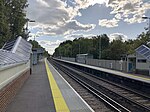
World's End, West Sussex
EngvarB from January 2014West SussexWest Sussex geography stubs

World's End is a neighbourhood located in Burgess Hill, West Sussex. It is thought that the name arrived with the railway – it was here that the 'up' line met the 'down' line during construction of the Brighton Main Line in what is now the World's End area.
Excerpt from the Wikipedia article World's End, West Sussex (License: CC BY-SA 3.0, Authors, Images).World's End, West Sussex
Leylands Road, Mid Sussex World's End
Geographical coordinates (GPS) Address Nearby Places Show on map
Geographical coordinates (GPS)
| Latitude | Longitude |
|---|---|
| N 50.9647 ° | E -0.1193 ° |
Address
Baan Thai 2
Leylands Road 7a
RH15 0QF Mid Sussex, World's End
England, United Kingdom
Open on Google Maps


