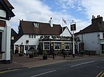
Joyden's Wood
Borough of DartfordForests and woodlands of KentParks and open spaces in the London Borough of BexleyWoodland Trust

Joyden's Wood is an area of ancient woodland that straddles the border between the London Borough of Bexley in South East London and the Borough of Dartford in Kent, England. It is located 2.7 miles (4.3 km) north west of Swanley, 3.3 miles (5.3 km) south east of Bexleyheath and 3.6 miles (5.8 km) south west of Dartford. It is one of over 1,000 woodlands in the United Kingdom looked after by the Woodland Trust. The first records of a wood on this site go back to the year 1600. It is also the name of a housing estate to the east of the woodland itself.
Excerpt from the Wikipedia article Joyden's Wood (License: CC BY-SA 3.0, Authors, Images).Joyden's Wood
Eden Road,
Geographical coordinates (GPS) Address Nearby Places Show on map
Geographical coordinates (GPS)
| Latitude | Longitude |
|---|---|
| N 51.426 ° | E 0.158 ° |
Address
Eden Road
DA5 2EG , Joydens Wood
England, United Kingdom
Open on Google Maps


