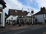
Bexley
Areas of LondonDistricts of the London Borough of BexleyEngvarB from February 2020Former civil parishes in the London Borough of Bexley

Bexley is an area of south-eastern Greater London, England and part of the London Borough of Bexley. It is sometimes known as Bexley Village or Old Bexley to differentiate the area from the wider borough. It is located 13 miles (21 km) east-southeast of Charing Cross and south of Bexleyheath. Bexley was an ancient parish in the county of Kent. As part of the suburban growth of London in the 20th century, Bexley increased in population, becoming a municipal borough in 1935 and has formed part of Greater London since 1965.
Excerpt from the Wikipedia article Bexley (License: CC BY-SA 3.0, Authors, Images).Bexley
Mill Row, London Bexley (London Borough of Bexley)
Geographical coordinates (GPS) Address Nearby Places Show on map
Geographical coordinates (GPS)
| Latitude | Longitude |
|---|---|
| N 51.441 ° | E 0.149 ° |
Address
Mill Row
DA5 1LA London, Bexley (London Borough of Bexley)
England, United Kingdom
Open on Google Maps


