place

Yorkshire

All pages needing cleanupCounties of England disestablished in 1974Counties of England established in antiquityPages with plain IPAUse British English from July 2018
Yorkshire
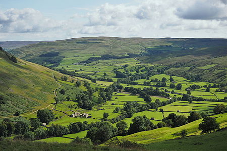
2015 Swaledale from Kisdon Hill

Yorkshire ( YORK-shər, -⁠sheer) is an area of Northern England and an historic county. It includes the ceremonial counties of East Riding of Yorkshire, North Yorkshire, South Yorkshire, and West Yorkshire, which are all part of the Yorkshire and the Humber region, and parts of Greater Manchester, Lancashire, Cumbria, and County Durham. Despite no longer being used for administration, Yorkshire retains a strong identity.The historic county was bordered by County Durham to the north, the North Sea to the east, Lincolnshire, Nottinghamshire, Derbyshire, and Cheshire to the south, and Lancashire and Westmorland to the west; it was the largest by area in the United Kingdom. The county was subdivided into three ridings – North, East, and West – which from the Middle Ages began to be used for local government functions. Between 1889 and 1974 the ridings were administrative counties. Yorkshire Day is observed annually on 1 August and is a celebration of the general culture of Yorkshire, including its history and dialect. Its name is widely recognised by British institutions, for example in the Royal Yorkshire Regiment of the British Army, in sport, and in the media. The emblem of Yorkshire is a white rose, which was originally the heraldic badge of the British royal House of York. The county is sometimes referred to as "God's own country".

Excerpt from the Wikipedia article Yorkshire (License: CC BY-SA 3.0, Authors, Images).

Yorkshire
Embsay Pasture Road,

Geographical coordinates (GPS) Address Nearby Places
placeShow on map

Wikipedia: YorkshireContinue reading on Wikipedia

Geographical coordinates (GPS)

Latitude Longitude
N 54 ° E -1 °
placeShow on map

Address

Embsay Pasture Road
BD23 6PR , Embsay with Eastby
England, United Kingdom
mapOpen on Google Maps

2015 Swaledale from Kisdon Hill
Share experience

Nearby Places

Danelaw
Danelaw

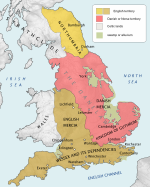
The Danelaw (, also known as the Danelagh; Old English: Dena lagu; Danish: Danelagen) was the part of England in which the laws of the Danes held sway and dominated those of the Anglo-Saxons. The Danelaw contrasts with the West Saxon law and the Mercian law. The term is first recorded in the early 11th century as Dena lage. The areas that constituted the Danelaw lie in northern and eastern England, long occupied by Danes and other Norsemen. The Danelaw originated from the invasion of the Great Heathen Army into England in 865, but the term was not used to describe a geographic area until the 11th century. With the increase in population and productivity in Scandinavia, Viking warriors, having sought treasure and glory in the nearby British Isles, "proceeded to plough and support themselves", in the words of the Anglo-Saxon Chronicle for 876.Danelaw can describe the set of legal terms and definitions created in the treaties between Alfred the Great, the king of Wessex, and Guthrum, the Danish warlord, written following Guthrum's defeat at the Battle of Edington in 878. In 886, the Treaty of Alfred and Guthrum was formalised, defining the boundaries of their kingdoms, with provisions for peaceful relations between the English and the Vikings. The language spoken in England was affected by this clash of cultures, with the emergence of Anglo-Norse dialects.The Danelaw roughly comprised these contemporary 15 shires: Leicester, York, Nottingham, Derby, Lincoln, Essex, Cambridge, Suffolk, Norfolk, Northampton, Huntingdon, Bedford, Hertford, Middlesex, and Buckingham.