Col du Ballon d'Alsace

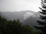
The Col du Ballon d'Alsace (1,178 m (3,865 ft)) is a mountain pass situated close to the summit of the Ballon d'Alsace (1,247 m (4,091 ft)) in the Vosges Mountains of France. It connects Saint-Maurice-sur-Moselle (Vosges) with Masevaux (Haut-Rhin) and Belfort. The Ballon d'Alsace was the first official mountain climb in the Tour de France on 11 July 1905 although the tour had crossed the slightly lower Col de la République (1,161 m (3,809 ft)) in each of the previous two years. The first rider to the top of the Ballon was René Pottier, with the stage being won by Hippolyte Aucouturier. Stage 9 of the 2005 Tour crossed this pass on the centenary of the original climb.
Excerpt from the Wikipedia article Col du Ballon d'Alsace (License: CC BY-SA 3.0, Authors, Images).Col du Ballon d'Alsace
Route du Ballon d'Alsace, Belfort
Geographical coordinates (GPS) Address Nearby Places Show on map
Geographical coordinates (GPS)
| Latitude | Longitude |
|---|---|
| N 47.820416666667 ° | E 6.835 ° |
Address
Route du Ballon d'Alsace
Route du Ballon d'Alsace
90200 Belfort
Bourgogne – Franche-Comté, France
Open on Google Maps


