place

Ballon d'Alsace

Mountains of Haut-RhinMountains of Haute-SaôneMountains of Vosges (department)Mountains of the Territoire de BelfortMountains of the Vosges
One-thousanders of FrancePages with French IPAPages with German IPA
Ballon dAlsace
Ballon dAlsace

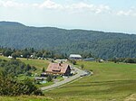
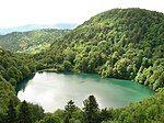
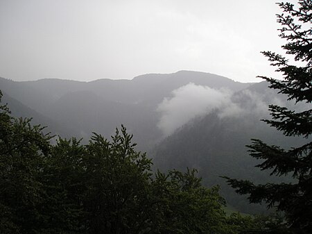
The Ballon d'Alsace (French pronunciation: [balɔ̃ dalzas]; German: Elsässer Belchen, pronounced [ˈɛlzɛsɐ ˈbɛlçn̩]) (el. 1247 m.), sometimes also called the Alsatian Belchen to distinguish it from other mountains named "Belchen") is a mountain at the border of Alsace, Lorraine, and Franche-Comté. From its top, views include the Vosges, the Rhine valley, the Black Forest, and the Alps. A road leads over a pass near the peak at the Col du Ballon d'Alsace, 1,171 m (3,842 ft). The pass is noted as the site of the first official mountain climb in the Tour de France on 11 July 1905, the first rider to the top of the climb being René Pottier and the stage being won by Hippolyte Aucouturier. Stage 9 of the 2005 Tour crossed this pass on the centenary of the original climb. Ballon d'Alsace features Alpine and Cross Country skiing tracks. The mountain is part of the so-called Belchen System, a group of mountains with the name "Belchen" (in German) that may have been part of a Celtic sun calendar.

Excerpt from the Wikipedia article Ballon d'Alsace (License: CC BY-SA 3.0, Authors, Images).

Ballon d'Alsace
Sentier Découverte Ballon d'Alsace, Thann-Guebwiller

Geographical coordinates (GPS) Address Nearby Places
placeShow on map

Wikipedia: Ballon d'AlsaceContinue reading on Wikipedia

Geographical coordinates (GPS)

Latitude Longitude
N 47.822222222222 ° E 6.8452777777778 °
placeShow on map

Address

Sentier Découverte Ballon d'Alsace
68290 Thann-Guebwiller
Grand Est, France
mapOpen on Google Maps

Ballon dAlsace
Ballon dAlsace
Share experience

Nearby Places

Bussang Pass
Bussang Pass

The Col de Bussang (Bussang Pass) is one of the busiest passes in France's Vosges mountains. Located in the Grand Est region of France at an altitude of 727 m, it links Lorraine and Alsace via Route Nationale 66 (also European Route 512). The two communes on the Lorraine side of the pass are Bussang, and the Alsace side is Urbès. The ridge crossing at Bussang is one of the main historical passes that have crossed the Vosges since ancient times, alongside the Col du Bonhomme, the Col du Donon, and the Col de Saverne. The importance of vehicular traffic over the Bussang pass has grown steadily since the last centuries of the Middle Ages, with the intensification of road and trade links between Flanders and Italy. The passage from the Vosges massif to the south is, therefore, part of a road network based on a so-called Lotharingian Europe, but by no means exclusive to the Flanders-Italy junction. To avoid climbing the passes of the southern Vosges, other trade routes took in the Alsatian plain or the Franche-Comté passes. The flourishing forestry and mining activities of the 15th to 17th centuries in the Upper Moselle Valley at the foot of the Ballon d'Alsace reinforced the local traffic around the Bussang pass, where raw material sites and processing factories were concentrated. The industrial and agropastoral activities of the Upper Moselle also encouraged the immigration of skilled workers from German-speaking countries on the Roman side of the pass, such as miners, marcaires from Switzerland, Alsace, and Germany, and coal miners from Sweden, the Tyrol and the Black Forest in the mountainous area between the Col du Bussang and the Col des Charbonniers. Defourny's Trésor des Chartes de Lorraine does not speak in terms of cols but rather of “passages” or “pertuis” in the village of Vôge. Situated at the crossroads of the Romanesque cultural sphere on the one hand and the Germanic world on the other, the Col de Bussang remains an ancestral frontier between various entities: sovereign states, temporal abbatial or canonical principalities, archdioceses, or linguistic areas. However, its vocation as a passageway has always outweighed its function as a natural frontier.