Rouge National Urban Park

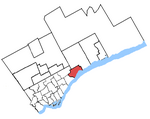
Rouge National Urban Park is a national urban park in Ontario, Canada. The park is centred around the Rouge River and its tributaries in the Greater Toronto Area. The southern portion of the park is situated around the mouth of river, in Scarborough, and extends northwards into Markham, Pickering, Uxbridge, and Whitchurch-Stouffville. Since 2011, Parks Canada has been working to nationalize and nearly double the size of the original Rouge Park. Parks Canada is planning to add more trails, education and orientation centres and improved signage and interpretive panels and displays throughout the park. Parks Canada introduced new educational programs to the park, including Learn-to-Camp, Learn-to-Hike, fire side chats, and other complimentary programming. Once fully established, the park will span 79.1 square kilometres (30.5 sq mi). Parks Canada managed 95% of the area as of June, 15, 2019, with the rest expected to transferred in the future. Of which, 46 square kilometres (18 sq mi) had been formally designated under the Rouge Urban National Park Act.
Excerpt from the Wikipedia article Rouge National Urban Park (License: CC BY-SA 3.0, Authors, Images).Rouge National Urban Park
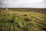
Mast Trail, Toronto Scarborough
Geographical coordinates (GPS) Address Nearby Places Show on map
Geographical coordinates (GPS)
| Latitude | Longitude |
|---|---|
| N 43.8083 ° | E -79.15 ° |
Address
Mast Trail
Mast Trail
M1B 5S3 Toronto, Scarborough
Ontario, Canada
Open on Google Maps


