place

Francis Hopkinson School

1927 establishments in PennsylvaniaArt Deco architecture in PennsylvaniaNortheast PhiladelphiaPublic K–8 schools in PhiladelphiaSchool District of Philadelphia
School buildings completed in 1927School buildings on the National Register of Historic Places in Philadelphia
Hopkinson School Philly

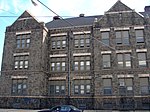
Francis Hopkinson School is a historic elementary school located in the Juniata neighborhood of Philadelphia, Pennsylvania. It is part of the School District of Philadelphia. The building was designed by Irwin T. Catharine and built in 1926–1927. It is a three-story, eight-bay, yellow brick building on a raised basement in the Art Deco style. It features an arched entryway with terra cotta trim and pilasters, a terra cotta cornice, and brick parapet. The school is named for Francis Hopkinson. The building was added to the National Register of Historic Places in 1988.

Excerpt from the Wikipedia article Francis Hopkinson School (License: CC BY-SA 3.0, Authors, Images).

Francis Hopkinson School
L Street, Philadelphia

Geographical coordinates (GPS) Address Nearby Places
placeShow on map

Wikipedia: Francis Hopkinson SchoolContinue reading on Wikipedia

Geographical coordinates (GPS)

Latitude Longitude
N 40.0084 ° E -75.1023 °
placeShow on map

Address

Hopkinson School

L Street
19124 Philadelphia
Pennsylvania, United States
mapOpen on Google Maps

Hopkinson School Philly
Share experience

Nearby Places

Carl Mackley Houses
Carl Mackley Houses

The Carl Mackley Houses, also originally known as Juniata Park Housing, is a private apartment complex in the Juniata neighborhood of Philadelphia, Pennsylvania. Built in 1933–1934 as single-family apartments, it opened in 1935. The project was sponsored by the American Federation of Full-Fashioned Hosiery Workers, with financing by the Housing Division of the Public Works Administration, of which it was the first funded project. The complex was named for a striking hosiery worker killed by non-union workers during the H.C. Aberle Company strike in 1930.The complex was designed in the International Style by Oscar Stonorov and Alfred Kastner. Since neither designer was a registered architect, they enlisted Philadelphia architect William Pope Barney (1890–1970) as the architect of record. The five-building complex covers an entire city block, bounded by Castor Avenue, Bristol, M, and Cayuga Streets. Four of the buildings, of three stories, each contain 71 one-, two-, and three-bedroom apartments, in six different layouts, above underground garages. The fifth building, originally a community center, now houses a laundry. The complex originally featured a swimming pool and wading pool, since filled in, and is now operated by private investors as rental apartments. The complex was added to the Philadelphia Register of Historic Places on June 3, 1982, and the National Register of Historic Places in 1998. It won a Landmark Building Award from the American Institute of Architects in 2000.

Wingohocking Creek
Wingohocking Creek

Wingohocking Creek was once a major tributary of another Philadelphia, Pennsylvania stream, Frankford Creek, which flows into the Delaware River. Frankford Creek was formed by the confluence of Wingohocking Creek and Tacony Creek (sections of which, in Montgomery County, Pennsylvania, are also called Tookany Creek). Since Wingohocking Creek is now obliterated, having been piped underground in the late 19th century, it can be confusing to look at a modern map, which shows Tacony Creek suddenly changing names "in the middle of the stream," so to speak, and becoming Frankford Creek. The point at which the name changes is near the present intersection of I and Ramona Streets, where the Wingohocking once joined the Tacony to form the Frankford Creek. What was once a major stream and the site of many mills and factories has been completely wiped off the map—all but the city's sewer maps, that is. The outlet of the Wingohocking Sewer is the largest in the Philadelphia sewer system, about 24 feet (7.3 m) high. It is visible from various points in the Juniata neighborhood and the adjoining golf course. The word "Wingohocking" may have originated from the indigenous Lenni Lenape for "favorite land for planting" or, perhaps, "crooked water." By other accounts, the stream was named by James Logan in honor of Chief Wingohocking, with whom he traded names in traditional Native American fashion as a sign of mutual respect.The stream now flows in a combined sewer (carrying both storm water and raw sewage) under Belfield Avenue and close to the route of Wingohocking Street in the Logan neighborhood of Philadelphia. It had two branches, the larger of which, the West Branch, reached as far as the Mount Airy neighborhood. In the 1860s, when municipal engineers drew up the preliminary drainage maps for Philadelphia's 129 square miles (330 km2), the conversion of many of the city's smaller streams into sewers became an integral part of the plan. The Wingohocking was converted beginning in the 1880s, with the final section of 21 miles (34 km) of streams finally obliterated in 1928. That mistakes were made in this process is evident in the city's Logan neighborhood, where more than 900 houses have been evacuated and demolished because of the threat of subsidence and collapse from weakened foundations caused by the inadequate fill material (fly ash) that was used when the stream was first covered. The city purchased most of the homes in this area (called the Logan Redevelopment Area) and demolished them, leaving only a ghostly, rectangular grid of streets as a reminder of the former urban landscape. The area is slated for commercial redevelopment. The creek formerly ran upstream from its confluence with the Tacony Creek in the vicinity of I Street and Ramona Avenue, west along Ramona two blocks to Cayuga then along Cayuga past G Street, and then Whitaker Avenue, then roughly parallel to Macalester Street and Hunting Park Avenue, staying north of Hunting Park, following the southerly boundary of Greenmount Cemetery near Front Street and Hunting Park Avenue. Sewer manhole pylons are visible in the lowest ground in this area. As described above, the Wingohocking Creek system was composed of two branches, which converged at a point located under Belfield Avenue west of modern-day Broad Street. The southerly branch, Wingohocking Creek proper, followed the path taken today by SEPTA's Chestnut Hill East rail line (built by the Philadelphia, Germantown & Norristown Railroad in 1833 and extended by the successor Philadelphia & Reading Railroad in the 1850s) between Sedgwick and Wister stations. The northerly branch, listed on maps as Mill Creek, began in Mt. Airy slightly north of Stenton Avenue and followed the path of Mansfield Avenue which was built on top of Mill Creek when it was arched over.A small section of Wingohocking Creek has been uncovered, or daylighted, at Awbury Arboretum. This is the only portion of the Wingohocking currently visible above ground. Although the creek is now extinct, its name lives on in Philadelphia's Wingohocking Street.

2015 Philadelphia train derailment

On May 12, 2015, an Amtrak Northeast Regional train from Washington, D.C. bound for New York City derailed and wrecked on the Northeast Corridor near the Kensington neighborhood of Philadelphia, Pennsylvania. Of 238 passengers and 5 crew on board, 8 were killed and over 200 injured, 11 critically. The train was traveling at 102 mph (164 km/h) in a 50 mph (80 km/h) zone of curved tracks when it derailed.Some of the passengers had to be extricated from the wrecked cars. Many of the passengers and local residents helped first responders during the rescue operation. Five local hospitals treated the injured. The derailment disrupted train service for several days.The National Transportation Safety Board determined that the derailment was caused by the train's engineer (driver) becoming distracted by other radio transmissions and losing situational awareness, and said that it would have been prevented by positive train control, a computerized speed-limiting system that was operational elsewhere on the Northeast Corridor, but whose activation at the wreck site had been delayed due to regulatory requirements. The track in question was also not equipped with ATC (automatic train control), an older and simpler system that had been operational for years on the southbound track of the curve at which the derailment occurred, and that also would have limited the train's speed entering the curve. Shortly after the derailment, Amtrak completed ATC installation on the northbound track.The 2015 wreck was the deadliest on the Northeast Corridor since 1987, when 16 people died in a wreck near Baltimore.The train engineer, 32-year old Brandon Bostian, was arrested and charged with one count of causing a catastrophe, eight counts of involuntary manslaughter, and 238 counts of reckless endangerment. On March 4, 2022, a jury acquitted Bostian on all counts.