place

Peter Minuit Plaza

1953 establishments in New York City2009 establishments in New York CityEvent venues in ManhattanSouth Ferry, ManhattanSquares in Manhattan
The Battery (Manhattan)
Peter Minuit Plaza (5722862286)

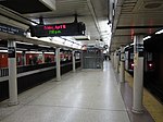
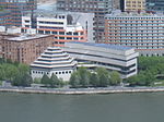
Peter Minuit Plaza is an urban square serving the intermodal transportation hub at South Ferry, and lies at the intersection of State Street and Whitehall Street in the Financial District of Lower Manhattan. The plaza is a heavy pedestrian traffic area just north of the Staten Island Ferry Whitehall Terminal and includes two exits for the New York City Subway's South Ferry/Whitehall Street station as well as the M15 SBS South Ferry Bus Loop at Peter Minuit Place, making this a busy intersection that is used by approximately 70,000 residents and visitors daily. The space was dedicated in 1953 (marking the 300th anniversary of the charter of New Amsterdam) as a smaller triangular plaza at the Kapsee, a historic point at the original southern tip of Manhattan, as part of the Battery's re-landscaping, with the Jewish Tercentenary Monument added in 1955. The plaza had a major redevelopment and expansion in 2009 (marking the 400th anniversary of the visit of the Halve Maen) with the addition of the New Amsterdam Plein and Pavilion to the original triangle, as well the extension of the plaza toward the ferry terminal, with the installation of subway exits in the new space.

Excerpt from the Wikipedia article Peter Minuit Plaza (License: CC BY-SA 3.0, Authors, Images).

Peter Minuit Plaza
Battery Park Underpass, New York Manhattan

Geographical coordinates (GPS) Address Nearby Places
placeShow on map

Wikipedia: Peter Minuit PlazaContinue reading on Wikipedia

Geographical coordinates (GPS)

Latitude Longitude
N 40.7033 ° E -74.01748 °
placeShow on map

Address

Statue Cruises

Battery Park Underpass
10004 New York, Manhattan
New York, United States
mapOpen on Google Maps

Peter Minuit Plaza (5722862286)
Share experience

Nearby Places

The Battery (Manhattan)

The Battery, formerly known as Battery Park, is a 25-acre (10 ha) public park located at the southern tip of Manhattan Island in New York City facing New York Harbor. It is bounded by Battery Place on the north, State Street on the east, New York Harbor to the south, and the Hudson River to the west. The park contains attractions such as an early 19th century fort named Castle Clinton; multiple monuments; and the SeaGlass Carousel. The surrounding area, known as South Ferry, contains multiple ferry terminals, including the Staten Island Ferry's Whitehall Terminal; a boat launch to the Statue of Liberty National Monument (which includes Ellis Island and Liberty Island); and a boat launch to Governors Island. The park and surrounding area is named for the artillery batteries that were built in the late 17th century to protect the settlement behind them. By the 1820s, the Battery had become an entertainment destination, with the conversion of Castle Clinton into a theater venue. During the mid-19th century, the modern-day Battery Park was constructed and Castle Clinton was converted into an immigration and customs center. The Battery was commonly known as the landing point for immigrants to New York City until 1890, when the Castle Clinton immigration center was replaced by one on Ellis Island. Castle Clinton then hosted the New York Aquarium from 1896 to 1941. In 1940, the entirety of Battery Park was closed for twelve years due to the construction of the Brooklyn–Battery Tunnel and the Battery Park Underpass. The park reopened in 1952 after a renovation, but then subsequently went into decline. The Battery Conservancy, founded in 1994 by Warrie Price, underwrote and funded the restoration and improvement of the once-dilapidated park. In 2015, the Conservancy renamed the park to its historic name of "the Battery".

Whitehall Building
Whitehall Building

The Whitehall Building is a three-section residential and office building near the southern tip of Manhattan Island in New York City, adjacent to Battery Park in lower Manhattan. The original 20-story structure on Battery Place, between West Street and Washington Street, was designed by Henry Janeway Hardenbergh, while the 31-story Whitehall Building Annex on West Street was designed by Clinton and Russell. The original building and annex are both at 17 Battery Place. Another 22-story addition at 2 Washington Street, an International Style building located north of the original building and east of the annex, was designed by Morris Lapidus. The original Whitehall Building and its annex has a Renaissance Revival style facade, and the two original structures' articulations consist of three horizontal sections similar to the components of a column—namely a base, shaft, and capital. Since the building is located on landfill along the Hudson River, its foundation incorporates a non-standard design. The Whitehall Building is named after the nearby estate of New Amsterdam colonial governor Peter Stuyvesant. The original building was built as a speculative development in 1902–1904 for Robert A. and William H. Chesebrough, a real estate company. The annex was built in 1908–1910, and 2 Washington Street was built in 1972. In 2000, the New York City Landmarks Preservation Commission (LPC) designated the Whitehall Building as an official city landmark. The upper floors of the original building and annex were converted to apartments, while the lower floors remain in use as an office building.