place

Kendrew Barracks

2012 establishments in EnglandBarracks in EnglandBuildings and structures in RutlandInstallations of the British Army
RAF Cottesmore geograph.org.uk 576309

Kendrew Barracks is a British Army barracks located 1.1 miles (1.8 km) north east of Cottesmore, Rutland, England. The barracks opened in 2012, on the site of the former RAF Cottesmore.

Excerpt from the Wikipedia article Kendrew Barracks (License: CC BY-SA 3.0, Authors, Images).

Kendrew Barracks
Cottesmore Road,

Geographical coordinates (GPS) Address Nearby Places
placeShow on map

Wikipedia: Kendrew BarracksContinue reading on Wikipedia

Geographical coordinates (GPS)

Latitude Longitude
N 52.729444444444 ° E -0.65138888888889 °
placeShow on map

Address

Cottesmore Road
LE15 7BL , Cottesmore
England, United Kingdom
mapOpen on Google Maps

RAF Cottesmore geograph.org.uk 576309
Share experience

Nearby Places

Cottesmore, Rutland
Cottesmore, Rutland

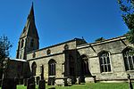
Cottesmore (often pronounced Cotts'more) is a village and civil parish in the north of the county of Rutland in the East Midlands of England. In terms of population it is the largest village in Rutland, and the third-largest settlement after Oakham and Uppingham. This is due in part to the presence of Kendrew Barracks (formerly RAF Cottesmore). The village's name means 'moor of Cott'.At the time of Edward the Confessor (mid 11th century), "Manors Cottesmore" was held, together with Greetham, by Saxon called Goda. Goda held 12 carucates of land, three of which were held in tax to the Danegeld. The King held three carucates in demesne and three socmen with 40 villeins and six bordarii held 20 carucates. Of the land held by the manor, one Goisfridus held half a carucate; he had one plough and eight villeins. Cottesmore also had 40 acres (160,000 m2) of meadow and a wood measuring a mile in length by seven furlongs in breadth. St Nicholas' Church, Cottesmore is a Grade II* listed building. The north aisle forms a RAF chapel, dedicated in 1949 to those who gave their lives while serving at RAF Cottesmore. A stained glass window was erected to the memory of Major General George Williams Knox CB (1838–1894). The colours of the 1st Battalion Scots Guards were gifted to the church by his widow and hang in the nave. The Cottesmore Benefice is part of the North Rutland Churches group.There are two primary schools in the parish: St Nicholas C of E (Aided) Primary School is in the village and Cottesmore Academy is on the military base. The Cottesmore Hunt takes its name from the village (although the kennels are not now in the parish). Sir William Lowther, 1st Earl of Lonsdale brought the foxhounds he had bought from Thomas Noel to Cottesmore in 1740. Three ships of the Royal Navy have been named HMS Cottesmore after the Cottesmore hunt. Prince Andrew, Duke of York commanded the minesweeper HMS Cottesmore (M32) from April 1993 until November 1994 and visited the village with members of his crew.

Greetham, Rutland
Greetham, Rutland

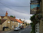
Greetham is a village and civil parish in the county of Rutland in the East Midlands of England. The village's name means 'homestead/village which is gravelly' or 'hemmed-in land which is gravelly'.The village is on the B668 road between the county town of Oakham and the A1 and on the north–south Viking Way long distance footpath linking the Humber Bridge and Oakham. The population of the civil parish at the 2001 census was 609 increasing to 638 at the 2011 census.The oldest parts of the Church of England parish church of St Mary the Virgin are Norman, but the church today is largely as it was rebuilt in the 13th–15th centuries. The west tower and spire are 13th or 14th century and the south porch was built in 1673. The church was restored in 1897 by Jethro Cossins. The church is a Grade I listed building. It is on Historic England's Heritage at Risk Register, at priority category: C – "slow decay; no solution agreed".Leicestershire and Rutland Wildlife Trust owns Merry's Meadows nature reserve, a SSSI in the parish that is important for species characteristic of unimproved grassland. East of the village just before the Sewstern Lane junction, just north of the B668 is Greetham Lime Quarry owned by the Dickerson Group of Waterbeach. Greetham has two pubs: the Plough and the Wheatsheaf, both on the B668. To the east is the Greetham Valley golf course. On the A1 near Stretton is a former pub, the Olde Greetham Inn, now owned by Construction Interior Design. The village well, of mid-19th century, has an inscription; "All ye who hither come to drink/Rest not your thoughts below/Remember Jacob's well and think/Whence "living waters" flow." It is Grade II listed.

Thistleton
Thistleton

Thistleton is the most northerly village in the county of Rutland, and a civil parish, in the East Midlands of England. The population of the village at the 2001 census was 99. It remained less than 100 at the 2011 census and was counted together with the civil parish of Stretton. The village's name means 'farm/settlement which is thistly'.The Thistleton area has shown evidence of Romano-British occupation including a large temple precinct and a possible small market settlement. To the north of the village there has been extensive mining for ironstone, a stone that has featured very prominently in the building of many churches and other buildings in the area for centuries. It was thought that the mining had obliterated evidence of the former greater extent of the village but much archaeology has survived showing that the original Romano-British settlement extended some 100 acres (0.40 km2) at least. Extensive surveys, brought about by the planning of a haulage road to the quarry to pass through the site of the ancient township, revealed features including a well-preserved Roman road and the skeleton of a child buried well away from the cemetery. The archaeology is ongoing as the mining continues.The village contains several listed buildings including the Old Rectory and the Church of St Nicholas. Many of the village's buildings are stone-walled and thatched. Although the church is of medieval origin, only the 14th-century three-stage tower, complete with gargoyles, remains. The church was rebuilt in the late 18th century by the Brudenells, and the rector, the Rev.d Sir John Henry Fludyer, 4th Baronet to whose family the elaborate chancel is a memorial. The newer building is 14th century in style; however, the shape of the apse is half an octagon externally but semi-circular inside. Most of the internal fittings, including the font and the organ, are relatively modern.Close by, to the south of the village, lies the RAF Cottesmore airfield which opened in 1938. The airfield is now the Army's Kendrew Barracks.