place

Cribb's Meadow

Leicestershire and Rutland Wildlife TrustNational nature reserves in EnglandNature Conservation Review sitesSites of Special Scientific Interest in Leicestershire
Cribb's Meadow path along former railway line

Cribb's Meadow is a 4.2-hectare (10-acre) nature reserve east of Wymondham in Leicestershire. It is owned and managed by the Leicestershire and Rutland Wildlife Trust, and is designated a biological Site of Special Scientific Interest under the name Cribb's Lodge Meadows. It is also a National Nature Reserve and a Nature Conservation Review site, Grade 2.The embankment of a disused railway runs through this ridge and furrow neutral meadow on boulder clay. The diverse flora includes adder's tongue fern, pepper saxifrage, hayrattle and green-winged orchid.There is access from Fosse Lane, and a footpath runs through the southern end.

Excerpt from the Wikipedia article Cribb's Meadow (License: CC BY-SA 3.0, Authors, Images).

Cribb's Meadow
Mill Lane, Melton Wymondham

Geographical coordinates (GPS) Address Nearby Places
placeShow on map

Wikipedia: Cribb's MeadowContinue reading on Wikipedia

Geographical coordinates (GPS)

Latitude Longitude
N 52.759 ° E -0.669 °
placeShow on map

Address

Cribb's Meadow

Mill Lane
NG33 5AF Melton, Wymondham
England, United Kingdom
mapOpen on Google Maps

Cribb's Meadow path along former railway line
Share experience

Nearby Places

Thistleton
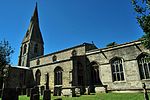
Thistleton

Thistleton is the most northerly village in the county of Rutland, and a civil parish, in the East Midlands of England. The population of the village at the 2001 census was 99. It remained less than 100 at the 2011 census and was counted together with the civil parish of Stretton. The village's name means 'farm/settlement which is thistly'.The Thistleton area has shown evidence of Romano-British occupation including a large temple precinct and a possible small market settlement. To the north of the village there has been extensive mining for ironstone, a stone that has featured very prominently in the building of many churches and other buildings in the area for centuries. It was thought that the mining had obliterated evidence of the former greater extent of the village but much archaeology has survived showing that the original Romano-British settlement extended some 100 acres (0.40 km2) at least. Extensive surveys, brought about by the planning of a haulage road to the quarry to pass through the site of the ancient township, revealed features including a well-preserved Roman road and the skeleton of a child buried well away from the cemetery. The archaeology is ongoing as the mining continues.The village contains several listed buildings including the Old Rectory and the Church of St Nicholas. Many of the village's buildings are stone-walled and thatched. Although the church is of medieval origin, only the 14th-century three-stage tower, complete with gargoyles, remains. The church was rebuilt in the late 18th century by the Brudenells, and the rector, the Rev.d Sir John Henry Fludyer, 4th Baronet to whose family the elaborate chancel is a memorial. The newer building is 14th century in style; however, the shape of the apse is half an octagon externally but semi-circular inside. Most of the internal fittings, including the font and the organ, are relatively modern.Close by, to the south of the village, lies the RAF Cottesmore airfield which opened in 1938. The airfield is now the Army's Kendrew Barracks.