North Cockerington

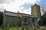
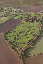
North Cockerington is a small village and civil parish in the East Lindsey district of Lincolnshire, England. It is situated approximately 3 miles (5 km) north-east from Louth. Village population has fluctuated between 150 and 200 since 1801 and currently remains at just below 200, with an equal distribution of males and females.North Cockerington was formerly known as Cockerington St Mary, distinguishing it from Cockerington St Leonard, now South Cockerington. In 1670 Sir Jarvis Scrope founded six tenements for poor people of North and South Cockerington. The village has no shops or public houses. The former post office in Meadow Lane, once called Ashdene, is now Pump Cottage. The village school is North Cockerington Church of England Primary School. The school serves the villages of North and South Cockerington, Alvingham, Yarburgh as well as Louth itself.The Greenwich Prime Zero meridian line passes through the village.
Excerpt from the Wikipedia article North Cockerington (License: CC BY-SA 3.0, Authors, Images).North Cockerington
Grange Lane, East Lindsey North Cockerington
Geographical coordinates (GPS) Address Nearby Places Show on map
Geographical coordinates (GPS)
| Latitude | Longitude |
|---|---|
| N 53.396655 ° | E 0.064822 ° |
Address
Grange Lane
Grange Lane
LN11 7ES East Lindsey, North Cockerington
England, United Kingdom
Open on Google Maps


