Hispania Balearica
3rd-century establishments in Spain3rd-century establishments in the Roman EmpireEstablishments in Spain in the Roman eraHistory of the Balearic IslandsLate Roman provinces ... and 2 more
Roman provinces in HispaniaStates and territories established in the 3rd century

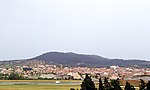
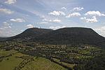
Hispania Balearica was a Roman province encompassing the Balearic Islands off the east coast of modern Spain. Formerly a part of Hispania Tarraconensis, Balearica gained its autonomy due to its geographic separation and economic independence from the mainland. The province included three major islands: Balearis Major (Majorca), Balearis Minor (Minorca), and Ebusus (Ibiza), and the small island of Colubraria or Ophiusa (Formentera). The islands were grouped as the Gymnesiae—Majorca and Minorca, and the Pityusae—Ibiza and Formentera.
Excerpt from the Wikipedia article Hispania Balearica (License: CC BY-SA 3.0, Authors, Images).Hispania Balearica
camí dels Moreis,
Geographical coordinates (GPS) Address Nearby Places Show on map
 Continue reading on Wikipedia
 Geographical coordinates (GPS)
| Latitude | Longitude |
|---|---|
| N 39.5 ° | E 3 ° |
Address
camí dels Moreis
camí dels Moreis
07260
Balearic Islands, Spain
Open on Google Maps