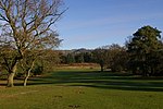
Colley Hill
Hills of SurreyReigateUse British English from May 2015

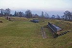
Colley Hill is part of the North Downs escarpment in the North Downs, Surrey, England. It is about 1 km east of Buckland Hills and 1 km west of Reigate Hill, all of which form part of the same escarpment. It is centred 30 kilometres (19 mi) south of London and forms a single scarp with Reigate Hill, peaking 2 miles (3 km) away at 235 metres above sea level. The scarp fluctuates in height but is continuous as far as Box Hill 5 miles (8 km) west. The term "Reigate Hill" also designates a neighbourhood of Reigate, and also a ward of Reigate and Banstead.
Excerpt from the Wikipedia article Colley Hill (License: CC BY-SA 3.0, Authors, Images).Colley Hill
M25, Reigate and Banstead
Geographical coordinates (GPS) Address Nearby Places Show on map
Geographical coordinates (GPS)
| Latitude | Longitude |
|---|---|
| N 51.256388888889 ° | E -0.21861111111111 ° |
Address
M25
KT20 7HD Reigate and Banstead
England, United Kingdom
Open on Google Maps
