place

Cogswell Dam

1935 establishments in CaliforniaAngeles National ForestDams completed in 1935Los Angeles County Department of Public Works damsLos Angeles building and structure stubs
Rock-filled damsSan Gabriel MountainsSan Gabriel River (California)
Cogswell
Cogswell

Cogswell Dam is a rockfill dam on the West Fork of the San Gabriel River in Los Angeles County, California. It is located in the San Gabriel Mountains, northeast of Mount Wilson, and within the Angeles National Forest. It forms Cogswell Reservoir, which has a capacity of 8,969 acre-feet (11,063,000 m3).The dam serves mainly for flood control in conjunction with San Gabriel Dam and Morris Dam downstream. San Gabriel Dam lies 13 miles (21 km) downstream.

Excerpt from the Wikipedia article Cogswell Dam (License: CC BY-SA 3.0, Authors, Images).

Cogswell Dam
West Fork Trail,

Geographical coordinates (GPS) Address Nearby Places
placeShow on map

Wikipedia: Cogswell DamContinue reading on Wikipedia

Geographical coordinates (GPS)

Latitude Longitude
N 34.244722222222 ° E -117.96527777778 °
placeShow on map

Address

West Fork Trail

West Fork Trail

California, United States
mapOpen on Google Maps

Cogswell
Cogswell
Share experience

Nearby Places

Stony Ridge Observatory

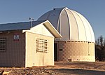
Stony Ridge Observatory is an astronomical observatory built by and for amateur astronomers in the mountains of Los Angeles County, California, in 1957. When installed, its 760 mm (30 in) Newtonian-Cassegrain likely ranked as 8th largest of all telescopes in California, and one of the largest amateur telescopes in the United States. The telescope is designed so that one of four Newtonian foci, or a Cassegrain focus, can be used. Asteroids 10168 Stony Ridge, 144633 Georgecarroll and 327030 Alanmaclure, were discovered at the observatory, and other scientific research (including an extensive lunar photography and mapping project in cooperation with Lockheed upon which the decision on the lunar lander touchdown site was based) has been conducted there. The observatory also has a 12-inch Cassegrain telescope and a number of accessory items, including CCD cameras and computer equipment. Facilities include an administration building with a small galley and bunkroom, the dome containing the 30-inch telescope, and a vault-style outhouse. The facility has Edison electric power and a landline telephone connection, but water must be carried in. Stony Ridge is located on a remote, restricted-access site north of Mt. Wilson, near Charlton Flat in the Angeles National Forest. In September 2009, Stony Ridge was at risk of being lost to a wildfire but escaped with minimal fire damage to one side of the outhouse building, although nearby ground cover was burned away, and the foliage of surrounding Coulter pines was destroyed.Recent restoration projects, completed in mid-2017, included: Re-installation of the original, George Carroll-designed right ascension and declination drive systems; installation of a Software Bisque-based "go to" system which will point the telescope at a computer-selected celestial object too faint to be seen with the naked eye or the telelescope's finder scopes; stripping and re-aluminization of the primary and secondary mirrors, which were significantly deteriorated by age, as well as smoke and heat from the infamous Station Fire, which burned more than 200 square miles of the Angeles National Forest surrounding the observatory in 2009.

Santa Anita Dam
Santa Anita Dam

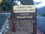
Santa Anita Dam, also known as Big Santa Anita Dam, is a concrete thin arch dam on Santa Anita Creek in the San Gabriel Mountains of Los Angeles County, California. Owned by the Los Angeles County Flood Control District, the dam serves for flood control, water conservation and debris control. The dam is 225 feet (69 m) high and 612 feet (187 m) long, holding 858 acre-feet (1,058,000 m3) of water with a maximum capacity of 1,028 acre⋅ft (1,268,000 m3). The catchment area for the dam is 10.8 square miles (28 km2). The dam was built between 1923 and 1927. The dam has three valves that control releases of stormwater.The dam is situated in the steep San Gabriel foothills, north of Sierra Madre and Arcadia. It is located just north of the boundary of the Angeles National Forest. The dam is visible from Santa Anita Canyon Road, which runs along the west slope of the Santa Anita Canyon and provides access into trails further upstream along Santa Anita Creek. The viewing window for the dam is very short, only about a half-mile; the access road which runs down into the canyon from Santa Anita Canyon Road is closed to the public. However, the First Water trail, which leads downstream from Chantry Flat along the creek, is said to provide access to the reservoir. Since the 1990s the maximum allowed storage of water has been restricted, to ensure that the dam will not collapse due to seismic instability. This has partially caused rapid silting of the reservoir and sediment removal was started in mid-2009. The reservoir was drained and about 6,750,000 cubic yards (5,160,000 m3) of sediment were removed. A staged rescue at the dam was broadcast in November 1958 as an episode of the syndicated U.S. television series Rescue 8 titled "The Chasm".