place

San Gabriel Wilderness

Angeles National ForestIUCN Category IbProtected areas of Los Angeles County, CaliforniaSan Gabriel MountainsSan Gabriel Mountains National Monument
Wilderness areas of California
San Gabriel Mountain Wilderness

The San Gabriel Wilderness is a wilderness area created in 1968 of more than 36,118 acres (150 km2) within the Angeles National Forest and San Gabriel Mountains National Monument. The area lies on the southern slopes of the San Gabriel Mountains, between the Angeles Crest and the West Fork of the San Gabriel River.The area was originally set aside as the Devils Canyon-Bear Canyon Primitive Area of 35,000 acres (140 km2).The San Gabriel Mountains were first preserved by the federal government in 1892 as the San Gabriel Timberland Reserve, established by U.S. President Benjamin Harrison and influenced by California conservationists, Abbot Kinney and John Muir. This forest reserve would later become part of the Angeles National Forest in which the San Gabriel Wilderness is now located.

Excerpt from the Wikipedia article San Gabriel Wilderness (License: CC BY-SA 3.0, Authors, Images).

San Gabriel Wilderness

Geographical coordinates (GPS) Address Nearby Places
placeShow on map

Wikipedia: San Gabriel WildernessContinue reading on Wikipedia

Geographical coordinates (GPS)

Latitude Longitude
N 34.246666666667 ° E -117.98555555556 °
placeShow on map

Address

Los Angeles County


California, United States
mapOpen on Google Maps

San Gabriel Mountain Wilderness
Share experience

Nearby Places

Stony Ridge Observatory

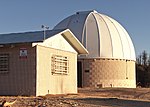
Stony Ridge Observatory is an astronomical observatory built by and for amateur astronomers in the mountains of Los Angeles County, California, in 1957. When installed, its 760 mm (30 in) Newtonian-Cassegrain likely ranked as 8th largest of all telescopes in California, and one of the largest amateur telescopes in the United States. The telescope is designed so that one of four Newtonian foci, or a Cassegrain focus, can be used. Asteroids 10168 Stony Ridge, 144633 Georgecarroll and 327030 Alanmaclure, were discovered at the observatory, and other scientific research (including an extensive lunar photography and mapping project in cooperation with Lockheed upon which the decision on the lunar lander touchdown site was based) has been conducted there. The observatory also has a 12-inch Cassegrain telescope and a number of accessory items, including CCD cameras and computer equipment. Facilities include an administration building with a small galley and bunkroom, the dome containing the 30-inch telescope, and a vault-style outhouse. The facility has Edison electric power and a landline telephone connection, but water must be carried in. Stony Ridge is located on a remote, restricted-access site north of Mt. Wilson, near Charlton Flat in the Angeles National Forest. In September 2009, Stony Ridge was at risk of being lost to a wildfire but escaped with minimal fire damage to one side of the outhouse building, although nearby ground cover was burned away, and the foliage of surrounding Coulter pines was destroyed.Recent restoration projects, completed in mid-2017, included: Re-installation of the original, George Carroll-designed right ascension and declination drive systems; installation of a Software Bisque-based "go to" system which will point the telescope at a computer-selected celestial object too faint to be seen with the naked eye or the telelescope's finder scopes; stripping and re-aluminization of the primary and secondary mirrors, which were significantly deteriorated by age, as well as smoke and heat from the infamous Station Fire, which burned more than 200 square miles of the Angeles National Forest surrounding the observatory in 2009.

Santa Anita Dam
Santa Anita Dam

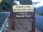
Santa Anita Dam, also known as Big Santa Anita Dam, is a concrete thin arch dam on Santa Anita Creek in the San Gabriel Mountains of Los Angeles County, California. Owned by the Los Angeles County Flood Control District, the dam serves for flood control, water conservation and debris control. The dam is 225 feet (69 m) high and 612 feet (187 m) long, holding 858 acre-feet (1,058,000 m3) of water with a maximum capacity of 1,028 acre⋅ft (1,268,000 m3). The catchment area for the dam is 10.8 square miles (28 km2). The dam was built between 1923 and 1927. The dam has three valves that control releases of stormwater.The dam is situated in the steep San Gabriel foothills, north of Sierra Madre and Arcadia. It is located just north of the boundary of the Angeles National Forest. The dam is visible from Santa Anita Canyon Road, which runs along the west slope of the Santa Anita Canyon and provides access into trails further upstream along Santa Anita Creek. The viewing window for the dam is very short, only about a half-mile; the access road which runs down into the canyon from Santa Anita Canyon Road is closed to the public. However, the First Water trail, which leads downstream from Chantry Flat along the creek, is said to provide access to the reservoir. Since the 1990s the maximum allowed storage of water has been restricted, to ensure that the dam will not collapse due to seismic instability. This has partially caused rapid silting of the reservoir and sediment removal was started in mid-2009. The reservoir was drained and about 6,750,000 cubic yards (5,160,000 m3) of sediment were removed. A staged rescue at the dam was broadcast in November 1958 as an episode of the syndicated U.S. television series Rescue 8 titled "The Chasm".

Mount Wilson Observatory

The Mount Wilson Observatory (MWO) is an astronomical observatory in Los Angeles County, California, United States. The MWO is located on Mount Wilson, a 5,710-foot (1,740-meter) peak in the San Gabriel Mountains near Pasadena, northeast of Los Angeles. The observatory contains two historically important telescopes: the 100-inch (2.5 m) Hooker telescope, which was the largest aperture telescope in the world from its completion in 1917 to 1949, and the 60-inch telescope which was the largest operational telescope in the world when it was completed in 1908. It also contains the Snow solar telescope completed in 1905, the 60 foot (18 m) solar tower completed in 1908, the 150 foot (46 m) solar tower completed in 1912, and the CHARA array, built by Georgia State University, which became fully operational in 2004 and was the largest optical interferometer in the world at its completion. Due to the inversion layer that traps warm air and smog over Los Angeles, Mount Wilson has steadier air than any other location in North America, making it ideal for astronomy and in particular for interferometry. The increasing light pollution due to the growth of greater Los Angeles has limited the ability of the observatory to engage in deep space astronomy, but it remains a productive center, with the CHARA array continuing important stellar research. The initial efforts to mount a telescope to Mount Wilson occurred in the 1880s by one of the founders of University of Southern California, Edward Falles Spence, but he died without finishing the funding effort. The observatory was conceived and founded by George Ellery Hale, who had previously built the 1 meter telescope at the Yerkes Observatory, then the world's largest telescope. The Mount Wilson Solar Observatory was first funded by the Carnegie Institution of Washington in 1904, leasing the land from the owners of the Mount Wilson Hotel in 1904. Among the conditions of the lease was that it allow public access.

Mount Wilson (California)

Mount Wilson is a peak in the San Gabriel Mountains, located within the San Gabriel Mountains National Monument and Angeles National Forest in Los Angeles County, California. With only minor topographical prominence the peak is not naturally noticeable from a distance, although it is easily identifiable due to the large number of antennas near its summit. It is a subsidiary peak of nearby San Gabriel Peak. It is the location of the Mount Wilson Observatory, which is an important astronomical facility in Southern California with historic 60-inch (1,524 mm) and 100-inch (2,540 mm) aperture telescopes, and 60-foot (18.3 m) and 150-foot (45.7 m) tall solar towers. The newer CHARA Array, run by Georgia State University, is also sited there and does important interferometric stellar research. The summit is at 5,710 feet (1,740 m). While not the tallest peak in its vicinity, it is high enough in elevation that snow can sometimes interrupt astronomical activities on the mountain. All of the mountains south of the summit are far shorter leading to unobstructed views across the Los Angeles Basin, Orange County, the Inland Empire, and out to Ventura County, San Diego County and the Pacific Ocean. On most days, Santa Catalina Island, some 65 mi (105 km) south, is visible. On clear days, other Channel Islands visible include San Clemente Island at 95 mi (153 km), Santa Barbara Island at 76 mi (122 km), San Nicolas Island at 107 mi (172 km), Santa Cruz Island at 98 mi (158 km) and San Miguel Island at 133 mi (214 km). At an elevation of 5,710 ft (1,740 m), the horizon on the ocean extends 92 mi (148 km). Mount Wilson is also heavily utilized for relay broadcasting of radio and television for the Greater Los Angeles Area.