Bracon Ash

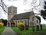
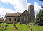
Bracon Ash is a village and civil parish in the South Norfolk district of Norfolk, England. The villages name has evolved from 'Bracken' as recorded by Christopher Saxton in 1574, with the later addition of 'ash-tree'. According to the 2001 United Kingdom national census, the Bracon Ash and Hethel Parish covered an area of 9.84 km2 and had a population of 446 people, spread between 171 households.[1]. The population at the 2011 census had increased to 460.St Nicholas Church, with no tower, is Grade 1 listed, like most other churches in South Norfolk, in the Domesday Book of 1086, with a church and a rectory.Centered around the Grade II listed war memorial most of the amenities have been converted into housing including a Bakery, Post-Office, School. The B1113 road runs through the village, which is about 6+1⁄2 miles (10.5 km) south of the city of Norwich. England's smallest official nature reserve Hethel Thorn is accessed from the west of the village.The children's play-park attracts visitors from the neighboring villages due to its excellent facilities and quiet location.Bracon Ash Common is a small area of woodland and ponds running adjacent to Mergate Lane. A public sculpture of 'Bracon Ash Village Sign' is located opposite the village hall. Designed by Jonathan Stevens as a project whilst studying at Wymondham College in 1994.
Excerpt from the Wikipedia article Bracon Ash (License: CC BY-SA 3.0, Authors, Images).Bracon Ash
School Road, South Norfolk Bracon Ash
Geographical coordinates (GPS) Address Nearby Places Show on map
Geographical coordinates (GPS)
| Latitude | Longitude |
|---|---|
| N 52.554751 ° | E 1.218796 ° |
Address
School Road
NR14 8EL South Norfolk, Bracon Ash
England, United Kingdom
Open on Google Maps


