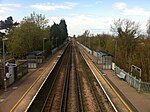
Boughton under Blean
Borough of SwaleCivil parishes in KentVillages in Kent

Boughton under Blean is a village and civil parish between Faversham and Canterbury in south-east England. "Boughton under Blean" technically refers only to the hamlet at the top of Boughton Hill; the main village at the foot of the hill is named Boughton Street, but the whole is referred to as "Boughton under Blean" or more commonly as just "Boughton". The Blean refers to the Forest of Blean, an area of long-standing Kent woodland covering over 11 square miles (28.5 sq. km). It had a population of 1,917 according to the 2011 Census. The parish includes the hamlet of Crouch.
Excerpt from the Wikipedia article Boughton under Blean (License: CC BY-SA 3.0, Authors, Images).Boughton under Blean
Canterbury Road, Borough of Swale Dunkirk
Geographical coordinates (GPS) Address Nearby Places Show on map
Geographical coordinates (GPS)
| Latitude | Longitude |
|---|---|
| N 51.292 ° | E 0.974 ° |
Address
Canterbury Road
Canterbury Road
ME13 9LE Borough of Swale, Dunkirk
England, United Kingdom
Open on Google Maps


