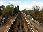
Dunkirk, Kent
Borough of SwaleCivil parishes in KentKent geography stubsVillages in Kent

Dunkirk is a village and civil parish between Faversham and Canterbury in southeast England. It lies on the Canterbury Road between Boughton under Blean and Harbledown. This was the main Roman road from the Kentish ports to London, also known as Watling Street.
Excerpt from the Wikipedia article Dunkirk, Kent (License: CC BY-SA 3.0, Authors, Images).Dunkirk, Kent
London Road, Borough of Swale Dunkirk
Geographical coordinates (GPS) Address Nearby Places Show on map
Geographical coordinates (GPS)
| Latitude | Longitude |
|---|---|
| N 51.2915 ° | E 0.9804 ° |
Address
London Road
London Road
ME13 9LG Borough of Swale, Dunkirk
England, United Kingdom
Open on Google Maps


