place

Bixley

Deserted medieval villages in NorfolkFormer civil parishes in NorfolkNorfolk geography stubsSouth Norfolk
St.Wandregesilius
St.Wandregesilius

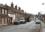
Bixley is a former civil parish now in the parish of Caistor St Edmund and Bixley, in the South Norfolk district of Norfolk, England. According to the 2001 census and 2011 census it contained 60 households and a population of 144. It covered an area south of Norwich including the village of Arminghall. On the 1st of April 2019 the parish was merged with Caistor St Edmund to form Caistor St Edmund and Bixley.The origin the name of Bixley has been studied in a paper by Keith Briggs; it means 'clearing in bushy land'. The name of Bixley near Ipswich has the same origin. The parish church of St Wandregesilius dates from 1272. St Wandregesilius is a Latinised form of St Wandrille and it is the only church dedicated to this 7th century French abbot. In May 2004 it was set on fire by arsonists and gutted. The church had no electricity and used gas cylinders for heating which it is believed were used by vandals to start the fire. Near the church is the site of a deserted medieval village.Sir Timothy Colman lived in Bixley Manor in the grounds of which is the seven-storey stump of Bixley Tower Mill dating from 1838. At eleven storeys this was once the tallest windmill in Norfolk and possibly the tallest in Britain. It was reduced to its current height in 1872.

Excerpt from the Wikipedia article Bixley (License: CC BY-SA 3.0, Authors, Images).

Bixley
Bungay Road, South Norfolk Caistor St Edmund and Bixley

Geographical coordinates (GPS) Address Nearby Places
placeShow on map

Wikipedia: BixleyContinue reading on Wikipedia

Geographical coordinates (GPS)

Latitude Longitude
N 52.60336 ° E 1.329174 °
placeShow on map

Address

Bungay Road

Bungay Road
NR14 7FR South Norfolk, Caistor St Edmund and Bixley
England, United Kingdom
mapOpen on Google Maps

St.Wandregesilius
St.Wandregesilius
Share experience

Nearby Places

Trowse railway station

Trowse was a station on the Great Eastern Main Line just south of Norwich. It was opened around the same time as Norwich Thorpe, and was intended to provide a short commute from the outer suburbs of Norwich. The bill for the Norwich & Brandon Railway (N&BR) received Royal Assent on 10 May 1844. Work started on the line in 1844 and the line and its stations were opened on 30 July 1845. Trowse station opened with the line and was situated west of Hethersett station. The line temporarily terminated at Trowse. The link into Norwich was delayed due to the need to build a bridge over the River Wensum that kept the river navigable. One month before the N&BR opened a Bill authorising the amalgamation of the Yarmouth & Norwich Railway with the N&BR came into effect and so Trowse station became a Norfolk Railway asset. On 15 December 1845 a swing bridge over the River Wensum was opened so Trowse ceased to be a terminus and the line from Brandon entered Norwich Station five months after the original line had opened. The Norfolk Railway also opened a line from Trowse towards Yarmouth so freight trains could avoid Norwich Station.Trowse closed and re-opened several times before closing permanently in 1939. It was briefly re-opened in March 1986 when Norwich was closed for electrification works and it served as the line's northern terminus. It closed again when the works finished.It is still largely in place, and could be re-opened should it ever be desired. Its close proximity to Norwich station makes this unlikely at present, though discussions regarding a possible re-opening have taken place.

Trowse Bridge
Trowse Bridge

Trowse Bridge is a single-track railway bridge which carries the Great Eastern Main Line over the River Wensum just outside Norwich in England at grid reference TG245076. The bridge was originally built in 1845 by George Parker Bidder, was rebuilt in 1905 and again in 1987. Like many swing bridges, the structure first lifts on hydraulic jacks before swinging open to allow the passage of water traffic. The bridge has frequently caused problems with navigation on the river due to its unreliability, leaving it unable to open.It is notable for being the only swing bridge in the United Kingdom to carry an overhead electrified railway track (25 kV 50 Hz). Other examples can be found along the Northeast Corridor in the United States; see for instance Portal Bridge, and the Galata Bridge over the Golden Horn in Istanbul. The power supply to trains is provided by an overhead conductor rail instead of a wire, and there are short lengths of overhead conductor rail either side of the bridge on the fixed approaches. There is a 40 mph (64 km/h) speed limit over the bridge in both directions as trains are about to arrive at, or have just departed from, Norwich Station. The bridge is also the home of Trowse Signal Box, which controls most of the Bittern Line from Whitlingham Junction to Sheringham. The line was resignalled in 2000, leading to the closure of a number of mechanical signal boxes with control moving to Trowse. The resignalling saw the end of one of the few remaining sections of single track main line controlled by tokens.

River Tas
River Tas

The River Tas is a river which flows northwards through South Norfolk in England - towards Norwich. The area is named the Tas Valley after the river. The name of the river is back-formed from the name of village of Tasburgh (E. Ekwall, English-River-names, p. 393). Tributaries which have their sources at Hempnall and Carleton Rode converge at Tasburgh. The river then flows on through Newton Flotman and Smockmill Common. In Shotesham Park the river splits into two channels which rejoin just above Shotesham ford. The pool here is a popular location in summer time for paddling, swimming and fishing. From Shotesham the river flows northwards through Stoke Holy Cross, Dunston, Caistor St Edmund, Markshall and Arminghall. It joins the River Yare at Trowse - just south of Norwich.The Tas valley contains many interesting historical sites including: an Iron Age hill fort at Tasburgh, the old Roman settlement of Venta Icenorum (now Caistor St Edmund) and the site of a woodhenge at Arminghall. The mill at Stoke Holy Cross was the first location of the Colman's mustard business. In Roman times the River Tas was considerably larger and provided a major transport route for the inhabitants of Venta Icenorum. Today it is a small river which winds through farmland. It contains roach, dace, occasional trout, small pike and some chub. One of the largest roach ever caught in the river was a 2.6 pound specimen landed by local angler Bill Coleman in 1972. The best dace was probably one of 1.2 pounds caught by W. Comer in 1943.