place

Bixley medieval settlement

Deserted medieval villages in NorfolkScheduled monuments in Norfolk
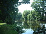
The site of Bixley village (geograph 4375858)

Bixley medieval settlement is a deserted medieval village in Norfolk, England, about 2 miles (3.2 km) south-east of Norwich. It is a Scheduled Monument.

Excerpt from the Wikipedia article Bixley medieval settlement (License: CC BY-SA 3.0, Authors, Images).

Bixley medieval settlement
Church Loke, South Norfolk Caistor St Edmund and Bixley

Geographical coordinates (GPS) Address Website Nearby Places
placeShow on map

Wikipedia: Bixley medieval settlementContinue reading on Wikipedia

Geographical coordinates (GPS)

Latitude Longitude
N 52.595 ° E 1.3352777777778 °
placeShow on map

Address

Saint Wandregesilius (Saint Wandregesilius' Church)

Church Loke
NR14 8RY South Norfolk, Caistor St Edmund and Bixley
England, United Kingdom
mapOpen on Google Maps

Website
heritage.norfolk.gov.uk

linkVisit website

The site of Bixley village (geograph 4375858)
Share experience

Nearby Places

Trowse railway station

Trowse was a station on the Great Eastern Main Line just south of Norwich. It was opened around the same time as Norwich Thorpe, and was intended to provide a short commute from the outer suburbs of Norwich. The bill for the Norwich & Brandon Railway (N&BR) received Royal Assent on 10 May 1844. Work started on the line in 1844 and the line and its stations were opened on 30 July 1845. Trowse station opened with the line and was situated west of Hethersett station. The line temporarily terminated at Trowse. The link into Norwich was delayed due to the need to build a bridge over the River Wensum that kept the river navigable. One month before the N&BR opened a Bill authorising the amalgamation of the Yarmouth & Norwich Railway with the N&BR came into effect and so Trowse station became a Norfolk Railway asset. On 15 December 1845 a swing bridge over the River Wensum was opened so Trowse ceased to be a terminus and the line from Brandon entered Norwich Station five months after the original line had opened. The Norfolk Railway also opened a line from Trowse towards Yarmouth so freight trains could avoid Norwich Station.Trowse closed and re-opened several times before closing permanently in 1939. It was briefly re-opened in March 1986 when Norwich was closed for electrification works and it served as the line's northern terminus. It closed again when the works finished.It is still largely in place, and could be re-opened should it ever be desired. Its close proximity to Norwich station makes this unlikely at present, though discussions regarding a possible re-opening have taken place.

Thorpe rail accident

The Thorpe rail accident occurred on 10 September 1874, when two trains were involved in a head-on collision at Thorpe St Andrew in the English county of Norfolk.The accident occurred on what was then a single-track rail line between Norwich railway station and Brundall. The two trains involved were the 20:40 mail from Yarmouth and the 17:00 express from London to Yarmouth. The latter had left Norwich Thorpe at 21:30 and would normally have had a clear run on its way to Yarmouth, since the mail train should have been held on a loop line at Brundall to allow the express to pass. On this occasion trains were running late. In such circumstances, when the timetable was upset, drivers had to have written authority to proceed further. Due to a series of errors (primarily, the telegraph clerk sending the authorization message before it had been signed by the appropriate official), both drivers received their authority, and anxious to make up for lost time, set off at speed along the single track. The accident, when it occurred around 21:45, resulted in both locomotives rearing into the air, and carriages reduced to wreckage. Both drivers and firemen were killed, as were 17 passengers with 4 later dying from their injuries. 73 passengers and two railway guards were seriously injured. Prompted by the accident, engineer Edward Tyer developed the tablet system in which a token is given to the train driver; this must be slotted into an electric interlocking device at the other end of the single-track section before another train is allowed to pass.

Framingham Earl
Framingham Earl

Framingham Earl is a small village situated south of Norwich, in the English county of Norfolk. It is next to Poringland and Framingham Pigot. It covers an area of 2.56 km2 (0.99 sq mi) and had a population of 834 in 354 households at the 2001 census, increasing to a population of 871 in 363 households at the 2011 Census. The villages name means 'Homestead/village of Fram's people'. The village was held by the Earl of Norfolk hence the 'Earl' addition. Within Framingham Earl is Framingham Earl High School, which is part of the Sapientia Education Trust. Sharing the same site is a Sports Centre, which opened in early 2006 and provides a range of exercise classes and sports opportunities to the people of the surrounding villages as well as giving the school extra space to use for PE and dance lessons. It is now managed by South Norfolk District Council. [1] The village has two churches, the Methodist Church and the Church of St. Andrew′s. St. Andrew's is one of 124 existing round-tower churches in Norfolk. The plan of the church is beguilingly irregular, with the chancel decreasing in width towards the east end. A pilaster strip in the south wall of the chancel curiously tapers with the narrow portion at the bottom: the whole building has a gnarled, irregular appearance which is a mark of Anglo-Saxon construction. Even the corners (quoins) are of flint, although these are somewhat larger on the whole than those built into the body of the walls. There is even, surprisingly, an attempt at herringbone-work, all in flint, and round splayed porthole windows dressed entirely in flints, not quite perfect circles. The German writer W. G. Sebald is buried in the churchyard of St. Andrew's.