place

Templers, South Australia

South Australia geography stubsTowns in South AustraliaUse Australian English from June 2013
TemplersChurch
TemplersChurch

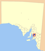
Templers (postcode 5371) is a small town on the Horrocks Highway north of Gawler, South Australia. The town was named after William Templer who, with his wife Martha, was the licensee of the North Star hotel in the area from 1846 to 1878. The Templers Primary School opened in 1873, but has since closed.The Mount Bethel Wesleyan Jubilee chapel was built in 1863 (completed 1864) by a people who had been meeting regularly in homes and sheds for worship since the early 1850s. It was initially part of the Gawler circuit. From 1870 it was part of a circuit consisting of Templers, Wasleys, Freeling and Sheaoak Log, with Stockport added from 1880.

Excerpt from the Wikipedia article Templers, South Australia (License: CC BY-SA 3.0, Authors, Images).

Templers, South Australia
Walladge Road, Light Regional Council

Geographical coordinates (GPS) Address Nearby Places
placeShow on map

Wikipedia: Templers, South AustraliaContinue reading on Wikipedia

Geographical coordinates (GPS)

Latitude Longitude
N -34.466666666667 ° E 138.73333333333 °
placeShow on map

Address

Walladge Road

Walladge Road
5371 Light Regional Council
South Australia, Australia
mapOpen on Google Maps

TemplersChurch
TemplersChurch
Share experience

Nearby Places

Roseworthy, South Australia

Roseworthy is a small town in South Australia, about 10 km north of Gawler on the Horrocks Highway. At the 2016 census, Roseworthy had a population of 994.Roseworthy has a large grain storage facility consisting of both storage silos and bunkers for grain grown in the surrounding areas, and grain is now taken by road transport to Port Adelaide for export where it was once taken by rail. Roseworthy is the junction of the former Peterborough railway line and Morgan railway lines, both constructed as broad gauge railway lines (although the Peterborough line was originally narrow gauge from Terowie to Peterborough), and remained that gauge for their entire service. Both lines were originally built to support export from copper mines, respectively at Burra and Kapunda before being extended beyond those towns. The railways later served primarily to carry grain to port instead of copper, but have now been supplanted by road transport. The Roseworthy campus of the University of Adelaide is the location of Australia's newest Vet School. The School of Animal & Veterinary Sciences provides education and training of animal and veterinary scientists in a research environment. The School offers three academic programs: Animal Science, Veterinary Bioscience and Doctor of Veterinary Medicine (DVM). Roseworthy is a popular stop for many truck drivers with the Roseworthy Roadhouse often bustling with resting travellers and transport drivers as they traverse along the Horrocks Highway.Roseworthy is in the Light Regional Council, the state electoral district of Schubert and the federal divisions of Barker and Grey.