Arneytown, New Jersey
Historic American Buildings Survey in New JerseyNRHP infobox with nocatNorth Hanover Township, New JerseyPopulated places in the Pine Barrens (New Jersey)Unincorporated communities in Burlington County, New Jersey ... and 5 more
Unincorporated communities in Monmouth County, New JerseyUnincorporated communities in New JerseyUpper Freehold Township, New JerseyUse American English from July 2023Use mdy dates from July 2023

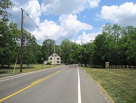
Arneytown is an unincorporated community located along Province Line Road on the border of North Hanover Township in Burlington County and Upper Freehold Township in Monmouth County of New Jersey. It is two miles (3.2 km) north of Jacobstown. Province Line Road was on the boundary line between the Provinces of East Jersey and West Jersey. The area was once called Upper Freehold by 18th-century Quaker settlers. With the establishment of the first post office in 1827, it became known as Arneytown.
Excerpt from the Wikipedia article Arneytown, New Jersey (License: CC BY-SA 3.0, Authors, Images).Arneytown, New Jersey
Ellisdale - Arneytown Road,
Geographical coordinates (GPS) Address Nearby Places Show on map
Geographical coordinates (GPS)
| Latitude | Longitude |
|---|---|
| N 40.101388888889 ° | E -74.566111111111 ° |
Address
Ellisdale - Arneytown Road 239
08514
New Jersey, United States
Open on Google Maps


